Fifth-Graders Dig Earth Science at Shake Rattle Rocks 2017
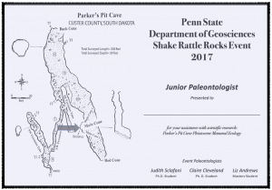
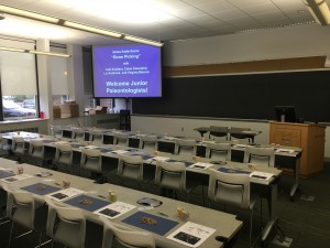
Nearly 450 fifth-grade students from local elementary schools attended the 2017 Shake Rattle Rocks event at Penn State to engage in earth science research. Students investigated everything from the effect of storm events on rivers to landscape topology at the Earth and Mineral Science Museum & Art Gallery’s kinetic sand exhibit. I teamed up with Judi Sclafani, Liz Anderson, and Virgina Marcon to share with students what it’s like to be a paleontologist. It’s great to introduce scientific research to students so early in their education. The key to success for this type of event is a strong combination of organization and teamwork. More than 200 students assisted with authentic scientific research by helping sort bones and teeth from 14,000 year-old sediments and learn about the impact of climate change on mammals. To say thank you, each student received a Junior Paleontologist certificate to recognize their contribution to earth science.

The first step in bone picking is developing a search image of what you are looking for in the sediment.
Penn State Undergraduates Travel to Denver to Study Geobiology
Students took to the field to experience the evidence behind the science. I worked with students from Dr. Wilf’s Geobilogy course to trace the Denver Museum’s “Prehistoric Journey” across the Denver Basin. The evidence was all around us, from the airport to the Florissant Fossil Beds National Monument.

Students explore the KP boundary, evidence for bolide impact and extinction 66 Ma years before present.
Designing an Interactive Ocean Acidification Display for Penn State’s Earth and Mineral Sciences Museum
“Ocean Acidification and its Effect on Marine Life” was the next logical step after participating in Penn State Geoscience’s Museums and Science Communication seminar. I worked with seven other graduate students to apply what we learned and design the display from the ground up. The most challenging part of the process was deciding what not to include in the display.
In the News: EMS Museum exhibit explores ocean acidification’s impact on microscopic sea life
Fifth-Graders Recreate Carboniferous Trees at Shake Rattle Rocks 2016

Lydia uses fossils of stems, roots, and leaves to interpret the morphology of Pennsylvanian-aged trees.
Sharing paleobotany with fifth-grade students at Penn State’s Shake Rattle Rocks 2016 community outreach event. More than 400 fifth-graders learned and experienced earth sciences hands-on with faculty and graduate students. Michael Donovan and I helped students reconstruct carboniferous trees from the fossil record. Students used evidence from permineralized wood, casts, leaf impressions, and coal ball peels to interpret the morphology of these ancient trees.
Teaching Geoscience Hands-On to Emerging Scientists and Engineers

Students in the field making observations and sketching an anticline, rock that changed shape when it was still deep below Earth’s surface due to heat and pressure.
As a Penn State Graduate Teaching Assistant, fall semester 2015, I welcomed emerging scientists and engineers to the geosciences through introductory hands-on labs. I met with more than 65 students each week to collect data, transform that data into practical knowledge, and communicate that knowledge to scientific peers as well as a general audience. Many of these students will go on to work for companies and organizations that will ask them to communicate not just with their colleagues, but with their communities.
Field labs were particularly exciting for all of us. We took the skills we learned in the lab and applied them to the geology of central Pennsylvania. Here we saw the work of local companies collecting cores (long columns of rock sample) on the same outcrops (bedrock exposed at the surface) we were investigating. During three separate labs, we collected detailed data at two outcrops approximately 20 miles apart and then toured the region to sketch the overall landscape. In the field, we talked about what we observed in plain language to develop our understanding of geologic terms, language that we could use to describe what we saw to non-scientists. At the end of the semester, students sketched a professional interpretation of the underlying geology that connected the two outcrop sites and wrote a technical interpretation of the process that generated the observed geology for a scientific audience.
Creating a Geobiology Museum Display to promote Geosciences at Southern Utah University
I worked with Kate Kupfer, a fellow undergraduate student at Southern Utah University, to create a static museum-style display that would illustrate some of the questions answered through geological research. Here, we presented a history of the Colorado Plateau through samples of petrified life and processes including fossils and ripples. Each sample is identified along with an explanation of information gained through research on similar samples.
Capturing Geoscience Issues through Imagery
After years of working and playing in the deserts and mountains of southern Utah, the last area to be mapped in the continental United States, you become attached to open, uninterrupted spaces. Humanity’s attempts at imposing incompatible values in confined spaces often result in conflict between intent and outcome. How do we satisfy the desire for socioeconomic stability for all versus the limits of our earth’s resources? What is wealth and how is it measured? In Environmental Geology, Dr. Johnny MacLean, Southern Utah University, challenged us to ask some of our own questions of value using imagery.
Learning to Create Interpretive Films for Natural History
My first efforts in natural interpretation began with a freshman Natural History course. Dr. John Taylor, Southern Utah University, encouraged us to spend time in the field getting to know our localities prior to making a short documentary film. This short film exploring Lake Quichapa in southwestern Utah is the shared result of three people spending time in the field in their own way. Quichapa Lake–a documentary


Leave a Reply
You must be logged in to post a comment.