
IMAGE OF THE WEEK
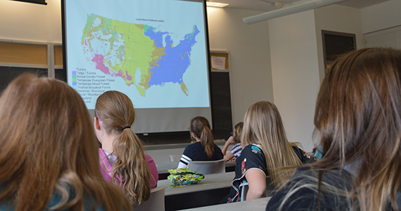
Young women from local schools attending Supporting Young Women in Geography (SYWIG) Day 2014 learn about physical geography. This year, SYWIG Day is March 18.
GOOD NEWS
Jennifer Baka will begin with us July 1, 2016, as our newest assistant professor of geography, with emphasis on energy policy.
Donna J. Peuquet will be awarded Fellow status by The University Consortium for Geographic Information Science (UCGIS) at its upcoming May 2016 Symposium in Scottsdale, Arizona.
Alumnus Greg Milbourne (B.S. 2015) accepted a position with Vricon in McLean,Virginia, as a 3D geospatial specialist.
Erica Smithwick received a 2015–16 Fulbright Grant: Measuring and Monitoring Forest Carbon Stocks and Biodiversity in South Africa.
NEWS
Coffee Hour with Kirk Maasch
Foot Steps of the Ancient Great Glacier of North America: A Long Lost Document of a Revolution in Nineteenth Century Geological Theory
John K. DeLaski practiced medicine in the Penobscot Bay region of Maine in the middle of the 19th century. He was also a naturalist with keen powers of observation. His study of the landscape led to the conclusion that a thick glacier had overtopped the highest hills, flooded all of Penobscot Bay, extended far to the east and west and probably was part of a greater continental glacier. He published his field observations and inferences in numerous articles in local newspapers and magazines, and in the American Journal of Science in 1864.
- 3:30 to 5:00 p.m.
- Refreshments are offered in 319 Walker Building at 3:30 p.m.
- The lecture begins in 112 Walker Building at 4:00 p.m.
- Coffee Hour To Go Webcast
- Next week: Gian Rocco “Of Timber Rattlesnakes, Red Beds, and Groundwater: in Pursuit of the ‘Holy Grail'”
Take back the tap: Pledge to eschew single–use plastic water bottles
Danielle Ruffe, a geography major and president of the Penn State “Take Back the Tap” campaign, wants students to choose tap water over bottled water. “This campaign focuses on human geography aspects of access to water in regions and promotes the drinking of tap water for students in State College instead of single-use plastic bottles,” Ruffe said. The goal of the campaign is to ban single-use plastic water bottles on campus in 5 years.
“Currently we are in a contest called Tap-a-palooza, a nation-wide contest to collect pledges from students saying that they will try to use a reusable water bottle whenever possible instead of a disposable plastic one,” Ruffe said. To pledge text “I<3 Tap!” to 69866 by March 22, World Water Day. The winning school gets funding for a new refilling station.
EMS benefiting THON dancers reflect on inspiration and support
Laser tag, making blankets for families fighting cancer, fishing — and of course, a 46-hour dance marathon — are some of the most memorable activities from the Penn State IFC/Panhellenic Dance Marathon (THON) activities for the College of Earth and Mineral Sciences (EMS) benefiting THON team. The group raised $71,302.45 in the fight against childhood cancer, making it the third-highest general organization in THON for 2016. The EMS benefiting THON group raised the largest amount of any general organization from 2011 to 2015.
World Campus remote sensing certificate helps GIS professionals
use drone data
Drones are suddenly everywhere — gathering crop data, monitoring air pollution, helping with search-and-rescue missions and even taking “drone selfies.” But the increase of data collection by drones, as well as by manned aircraft and satellites with advanced digital sensors, creates a need for experts who can interpret and apply the rapidly expanding data and images generated by them.
RECENTLY (OR SOON TO BE) PUBLISHED
Domains of uncertainty visualization research: a visual summary approach
By Jennifer Smith Mason, David Retchless , Alexander Klippel
In Cartography and Geographic Information Science
DOI: 10.1080/15230406.2016.1154804
The inherent uncertainty of geospatial data has engendered a critical research agenda addressing all facets of uncertainty visualization due to the communicative efficiency of graphical representation. To organize this broad research area, we have reviewed literature on geospatial uncertainty visualization and systematically and iteratively classified research in this field. Upon creating a classification, we developed several visual summaries over time, refining the classification and subsequent graphic as new relevant topics emerged. This visual summary extends current existing approaches to taxonomies by allowing users a quick visual overview of relevant topics in a research area at a glance.
There׳s an app for that: development of a smartphone app to promote active travel to a college campus
By Melissa Boppa, Dangaia Sims, Stephen A. Matthews, Liza S. Rovniak, Erika Poole, Joanna Colgan
In Journal of Transport & Health
DOI: 10.1016/j.jth.2016.02.007
Active travel (AT) is associated with many health benefits, however rates of AT remain low in the USA. Using technology to target population level AT behavior allows for the widespread dissemination of behavior change messages. Limited evidence exists on an effective process for developing and tailoring apps for a specific population. Therefore the purpose of the current study was to document the development process of a smartphone app for promoting AT to a college campus.