So this week was one of the most unique weeks yet in my time here at Penn State so far. Starting the week with freezing rain on Monday, followed by a nice sneak peek of spring on Wednesday, and finally lake effect snow with arctic temperatures to close the week. So here is a description of what caused us to have such a weird weather week.
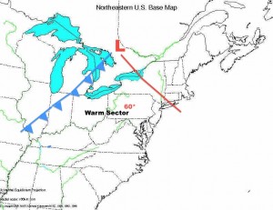
In figure one you can see there is a center of low pressure in Canada, which is the sole reason behind the weather this week. As you can see the is a warm front (red line) to our east and a cold front (blue line) to our west. Being in between both of these caused us to lie in what is known a warm sector, which had temps in the 60’s
A warm sector is caused by the rotation of air around the center of low pressure. As the air rotates counter clockwise around the low, it draws warm moist air from the Gulf of Mexico which gave us temperature in the upper 50’s.
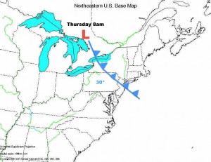
Just past 9pm on Wednesday, the cold front past through Pennsylvania, and are temperatures began to drop steadily, and they are still dropping. By 8am Thursday morning we were at 30 degrees.
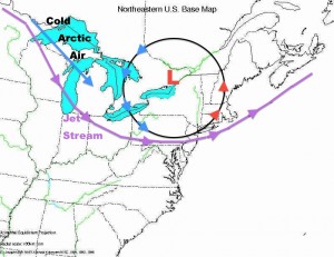
So what caused the snow on Thursday? Remember that the air around the centre of low pressure rotates counter clockwise, so after the low moved to our east, this brought cold air from the north. This cold air moved across the warmer moist air above the great lakes, which caused us to get the lake effect snow we saw on Thursday.
In the map image above, you can see that the jet stream curves down from the north and travels through our area. This is going to bring the return of cold temperatures for next week, so bundle up.
Blank US map by Northern Arizona University, Department of Geography.


