
The Garmin Model 60 GPS receivers were tested at five different points around the Mont Alto campus. At each point seven teams recorded 30 measurements. The measurements were combined for analysis. The true position was assumed to be the average easting and northing coordinates. The distance from the correct position, or error, was calculated. The mean, standard deviation, minimum, maximum and other descriptive statistics were calculated. The error data was separated into half meter classes in the following histogram.
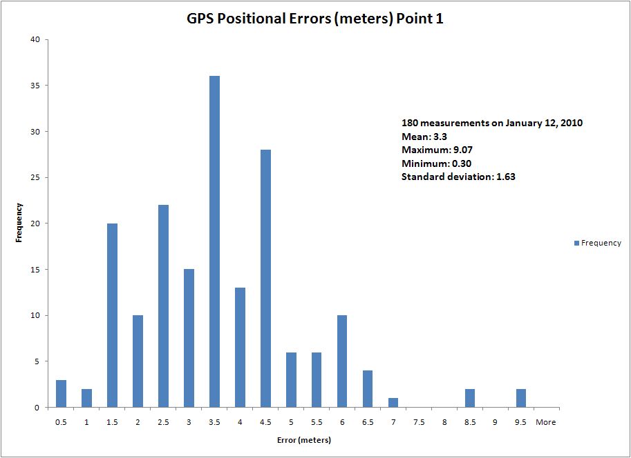
This table from the first point, located next to the General Studies building, shows the result. The average error of 3.3 meters is within the parameters for this model of GPS receiver.