Green play infrastructure:
[Re]Connecting children with nature in underserved urban neighborhoods
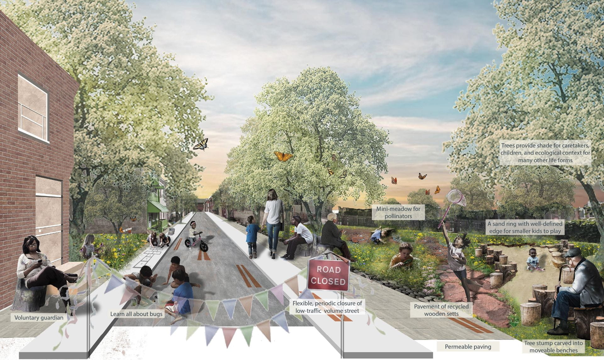
Children’s play is increasingly controlled, costly and standardized with engineered structures and surfaces rather than infused with natural processes and organic materials (Ball et al., 2019). Connecting children with nearby nature has become a movement in education, community development, and health and therapeutic settings (Chawla, 2015). However, access to nature-based playscapes in underserved, lower-income neighborhoods is usually extremely limited, impacted by disparities of race, class, and gender, and higher rates of emotional disorder (McCormick, 2017). In these contexts, misused and neglected vacant lots and streets and related interstitial spaces can be (re)claimed and redesigned as playscapes that support active, engaged, meaningful, and socially interactive play. Place-based design and micro-programming can knit these elements and processes together as a play system spatially through a combination of top- down GIS data and bottom-up site analyses. This case study addresses the ample opportunity to re-engage kids and city nature in underserved neighborhoods in Philadelphia, Pennsylvania that are experiencing persistent lot vacancy and degraded urban infrastructure. Methods and theories used in the project include GIS-based suitability analysis, drawing on geo-spatial crime and safety measures with roots in criminology and urban sociology; natural resource assessment with roots in urban ecology; and existing housing occupancy / structural condition and streetscape conditions with roots in urban policy and landscape urbanism. Finally, a play network with eight playscape categories adapted from the literature is revealed as an emergent pattern that my advisor and I have termed green play infrastructure.
Advisers/Committee


