Bald Eagle Weekend Trip

http://elikes.s3.amazonaws.com/wp-content/uploads/sites/4/2015/11/1z1E5.jpg
“There is a pleasure in the pathless woods, There is a rapture on the lonely shore, There is society, where none intrudes, By the deep-sea, and music in its roar: I love not man the less, but Nature more.” George Gordon, Lord Byron
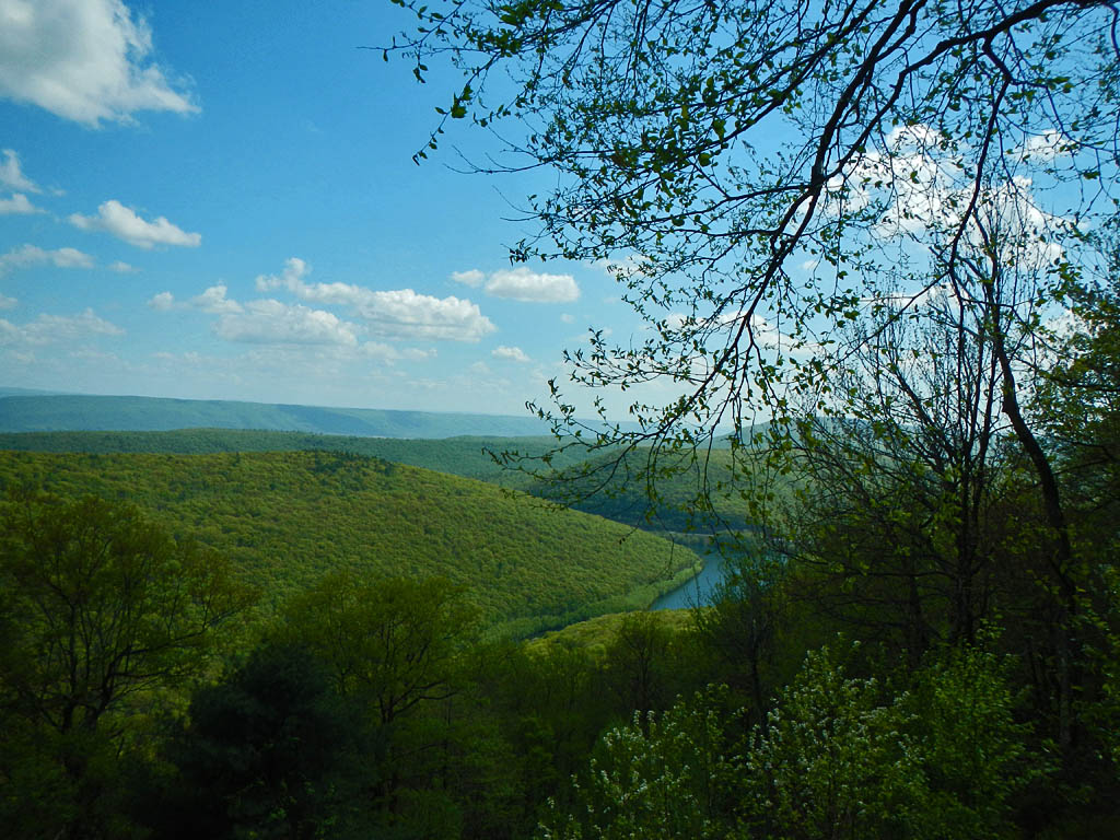
This week’s backpacking trip is an exploration of Pennsylvania’s Bald Eagle State Forest. This historical parcel of land is named after the famous Native American leader, Chief Bald Eagle, and is composed of 193,424 acres of mountains, streams, and numerous tracts of old growth forest. What’s really interesting about this state forest is that it covers parts of central Pennsylvania’s sharp ridges as well as many valleys between them. The valleys create pockets of ecosystems that differ slightly from one another: a hodgepodge of different natural areas.
https://www.pahikes.com/images/stories/trails/picts/ms33/ms33_04.jpg
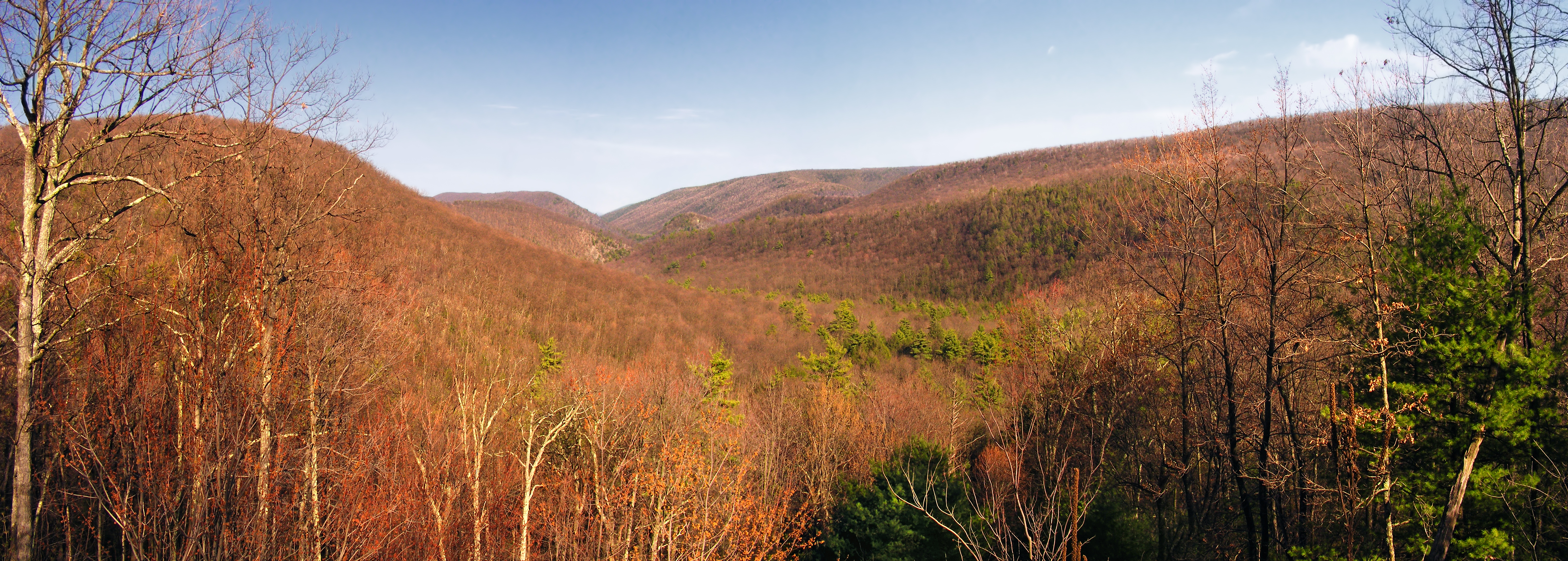
The trip I’ve planned is a 24 mile hike over the course of 2 1/2 days and 2 nights. It crosses two of the aforementioned natural areas called Halfway Run Natural Area and The Hook Natural Area. Halfway Run Natural Area is comprised of 407 acres of land with mixed oak and conifers growing in pingo scars, depressions left from glacial movement and melting. The second natural area is The Hook Natural Area which is a much bigger tract of land: almost 5,200 acres. This is an interesting area because an entire watershed is encompassed within it.

http://fcdn.mtbr.com/attachments/pennsylvania/573745d1286922901-bald-eagle-state-forest-smallbridge.jpg
I am excited to share this hike with you because I’ve used purple lizard maps to plan it out. Purple lizard maps is an independent cartographic design firm that makes, in my opinion, beautiful and informative maps of parks and forests mainly in the Midwest. What I think is the most fun thing about these maps is that they have little tiny lizard symbols hidden across their maps that make hiking almost like a scavenger hunt. These lizards can represent all sorts of things, from a gorgeous vista to a fresh spring, a rickety fire tower or sometimes… nothing. The hike I’ve planned has is a route that hits four different lizards
Let’s go for a hike!
https://upload.wikimedia.org/wikipedia/commons/6/6c/Bald_Eagle_State_Forest_Valley.jpg
This hike will be including a lot of different trails; 11 different trails to be precise. It’s super important that you have a map with you as so many twists and turns can leave you a bit lost. If you don’t want to invest in a sturdy purple lizard map, try this one from the DCNR.
A great place to park would be the Tea Springs Picnic Area which is on the corner of White Deer Pike and Old Tea Spring Rd. Your first lizard spotting is right here… and we’re off!
Friday (7.5mi): Today’s hike begins in the afternoon on the Tea Knob Tr. You might have to walk east a bit on Old Tea Spring Rd to get to the trail head. Head south on Tea Knob Tr until you get to White Deer Pike which will continue south onto Fourth Gap Tr. About two and half miles in, you will come across White Deer Creek which is your first option to filter some fresh water. After crossing the creek, the trail name transitions from Fourth Gap Tr to Cracker Bridge Tr and continues south for another two miles where it crosses Old Tram Tr. Turn right onto Old Tram Tr. In another two and a half miles you’ll enter Halfway Run Natural Area and you will cross Rocky Corner Tr. The trail will fork; take the left fork called Overlook Tr. After half a mile you reach your second lizard! Feel free to set up camp right around here where you might have an amazing view of the sunrise in the morning. Hang your bear bag, heat up some dinner, and love the life.

http://sirbikesalot.com/uploads_images/2006/IMG_0964.jpg
Saturday (12 mi): Rise and shine! Breathe a breath, and thank the earth for a spectacular show. Now pack your bags and hit the trail. Start off south on Overlook Tr, and in no time at all you’ll come across a parking lot. Turn left on the paved road then turn right on the next paved road you come across. Be sure to take in the Natural Area as you go, especially the gorgeous Halfway Lake where you can fill up your water for the day. Bake Oven Tr will cross right across your path and you should turn left so you’re going west. Continue along this trail as it changes into Brush Hollow Tr. Around two and a half miles, Yankee Run Tr will intersect Brush Hollow Tr and you should turn left and ride that road until it ends at Pine Creek Rd. Turn left onto Pine Creek Rd where it will be about 3/4 of mile until you reach Frederick Tr. Turn right and you’ve entered The Hook Natural Area. You’ve also started the ascent to the top of Sharpback Mountain, so have fun with that 600 foot, steep climb. At the top of the mountain is Old Shingle Rd which you should turn left on and hike for a mile or so until you reach Molasses Gap Tr. If you hike that north for a mile you can find the third lizard. There’s also a multitude of creeks in that area, so feel free to fill your water bottle. Maybe stop for a nice lunch. Your about seven miles in. Four miles left.
Back track south down Molasses Gap and turn left on Hook Tram Tr. Hike alongside of a lovely creek and cross it when the path forks with Knoll Ridge Tr on your left. Follow this trail until it ends at Buffalo Path. Turn left on Buffalo Path, and hike north until Jones Mtn Rd crosses your trail. Turn left on the road, and hike 1/4 mile to the next lizard. Scope it out then head back to Buffalo Path. Hike another mile or two until you come across a perfect camping spot. Spread out for the night and sleep like you’ve worked yourself to the max. Which you have.

http://www.pahikes.com/images/stories/trails/picts/tt1/tt1_02.jpg
Sunday (6.5 mi): Wake up sore and happy. Today’s hike is the least confusing and quite straightforward (literally). Set out northward on Buffalo Path. Cross Bake Oven Trail, but don’t turn. Cross Cracker Bridge Tr and do turn; turn left. Keep going north the remaining five and a half miles. This should look familiar because you did it on Friday. The last mile hope desperately your car is still parked safe and sound. Maybe it’s just me, but I get super paranoid about this. Reach your car and give yourself a pat on the back for completing a difficult journey. Treat yourself to an ice cream cone or an entire pizza. You deserve it!
Happy Hiking!
Audrey
Leave a Reply
You must be logged in to post a comment.
2 Responses to “Bald Eagle Weekend Trip”
What an awesome and precise post! Bald Eagle looks especially attractive since it has a lot of ecosystems and sites to see. Although it’s a long hike it seems that Bald Eagle has lengthy trails and beautiful attractions to see. I also like how you included purple lizard maps, for such a long trip it’s nice to have attractions to keep you going and motivated!
All your posts are about such beautiful places! I would love to go hiking here for a weekend. I really like how you detailed all the specifics out so it would be easy to follow. I also enjoy your quotes, they make me want to go outside and enjoy nature.