
IMAGE OF THE WEEK
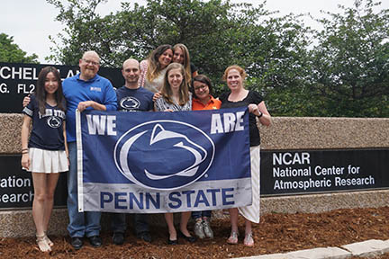 GEO Lab at NCAR: Members of the The GeoInformatics and Earth Observation Laboratory at the National Center for Atmospheric Research in Boulder, Colorado.
GOOD NEWS
Send your good news to share to geography@psu.edu.
NEWS
Where are they going? Using social media to understand human movement and disease transmission
The emergence of new diseases and the re-emergence of old diseases, leading causes of death worldwide, are an increasing challenge. Recent examples include Ebola in Sierra Leone and Guinea, Polio in Somalia and Cameroon, and MERS in the Arabian Peninsula, according to the Centers for Disease Control. Disease does not walk down the road by itself; it is carried by humans. An integral part of defining how diseases are spread comes from understanding human movement in places where it is difficult to track.
The findings from a recent study conducted by Justine I. Blanford, Zhuojie Huang, Alexander Savelyev, and Alan M. MacEachren, published on PLOS ONE, show that Twitter can be used to capture human mobility at a level of detail and timeliness not previously possible using other means such as cell phones, dollar bill tracking, or airline traffic data.
Shale Network fosters collaboration, focuses on water quality
A diverse group — from natural gas industry representatives to environmental advocates — gathered recently to discuss the impact of gas drilling on waterways at the 2015 Shale Network conference. The annual workshop gives scientists a chance to share what they’ve learned over the last year about the impact of Marcellus shale gas drilling on the region’s streams and rivers, and to plan the best way to monitor water quality going forward.
The new AAG Guide is now available
Looking for information about geography programs in your area of interest? The AAG Guide to Geography Programs in the Americas is a complete and invaluable reference for faculty, prospective students, government agencies, and private firms. It includes detailed information on undergraduate and graduate geography programs in the United States, Canada, and Latin America, including degree requirements, curricula, faculty qualifications, program specialties, financial assistance, and degrees completed.
RECENTLY (OR SOON TO BE) PUBLISHED
• Bernhardt, J. (2015), “Determining Regional Weather Patterns from a Historical Diary.” Weather, Climate, and Society. doi: 10.1175/WCAS-D-15-0016.1
Prior to the 20th century, there was a dearth of official local weather and climate observations for much of the United States outside of major cities. Useful information can be gleaned, however, from primary accounts, such as historical diaries kept by farmers and others whose interests were tied to the land. Herman Smith—a farmer in west-central New York State—kept a detailed record of daily life, including weather characteristics such as temperature, precipitation, and wind, for his farm near Covert. Two full years of his diary, 1884 and 1886, were recently published, and selected for study. Although typically not numeric data, the lexicon used in the diary to describe relative heat and cold allow Smith’s observations to be analyzed semi-quantitatively in order to determine the weather experienced that year including factors affecting the growing season, as well as significant weather and climatic events.
• Bracegirdle, T.J., N. Bertler, A.M. Carleton, Q. Ding, C.J. Fogwill and J.C. Fyfe: A multi-disciplinary perspective on climate model evaluation for Antarctica. Bulletin, American Meteorological Society: in press (2015).
Over the 21st century large changes in climate are projected for Antarctica and the Southern Ocean under scenarios of greenhouse gas increase and stratospheric ozone recovery. These changes would potentially have important environmental and societal implications, for example sea level change, global ocean heat /carbon uptake, and ecosystem function. However, our ability to make precise estimates of these impacts is hampered by uncertainties in state-of-the-art climate models. Model evaluation is a key step in reducing this model uncertainty by helping to identify biases and shortcomings common to the current generation of models and highlighting priorities for future model development. The evaluation of climate models’ representation of Antarctic climate from the perspective of long-term 21st century climate change was the subject of a workshop organized by Antarctic Climate 21 (AntClim21), one of six current Scientific Research Programmes of the Scientific Committee on Antarctic Research (SCAR) (see http://www.scar.org/srp/antclim21)
• Mayewski, P.A., T. Bracegirdle, I. Goodwin, D. Schneider, N.A.N. Bertler, S. Birkel, A. Carleton, M.H. England, J-H Kang, A. Khan, J. Russell, J. Turner, and I. Velicogna: Potential for Southern Hemisphere climate surprises. Journal of Quaternary Science, 30(5), 391-395. DOI: 10.1002/jqs.2794.
Climate model results suggest that future climate change in Antarctica will be accompanied by continued strengthening and poleward contraction of the Southern Ocean westerly wind belt. Paleoclimate records suggest past changes in the westerly winds can be abrupt and that healing of the Antarctic ozone hole could lead to poleward contraction of the westerlies and increased meridional atmospheric transport of warm air regionally into Antarctica. An abrupt shift to more meridional circulation could lead to notable changes in moisture availability for extra-Antarctic regions, increased Antarctic ice sheet disintegration and more rapid sea-level rise.
DOG OF THE WEEK
 Who is this dog? Who is his human? Send your answer and/or a photo of your dog to geography@psu.edu for our mystery dog of the week!