
IMAGE OF THE WEEK
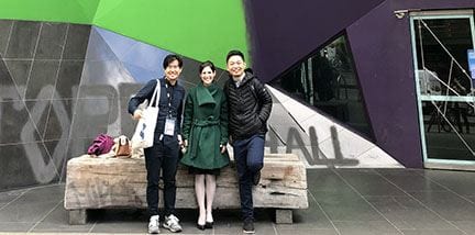
Xi Liu shares this photo of members of the Friendly Cities Lab (left to right: Hanzhou Chen, Clio Andris, Xi Liu) taken in Melbourne at GIScience 2018, held August 28–31. At GIScience 2018, the lab organized a workshop, presented two workshop papers and gave an extended abstract at the main conference. The photo was taken in front of Storey Hall at RMIT University.
GOOD NEWS
Christine Mares (’03g) is a new instructor this semester at Northern Arizona University. In addition, for the past 3.5 years she has been working at NAU for the Wildland Fire Education and Training Collaborative (WETC) as a script writer and editor, writing scripts for wildland fire educational videos. She will continue in this role as well as her new instructor duties. WETC videos are free and non-proprietary, said Mares, “so please feel free to use and share, plus we are working on new videos as we speak. Comments and suggestions are always helpful, and we welcome new collaborators!” The work is showcased here: worldofwildlandfire.org.
Guido Cervone won a grant from DARPA for his project: Expanded Dimensionality Imaging Spectroscopy via Deep Learning.
Anthony Robinson was interviewed about his research on viral maps by Fast Company for their article: “The next great fake news threat? Bot-designed maps”
NEWS
NSF funds $3 million graduate training program focused on Food-Energy-Water
The National Science Foundation has awarded a $3 million grant to an interdisciplinary team of Penn State researchers to create a new graduate program that will train students to find solutions to real-world problems facing Food-Energy-Water (FEW) systems.
The project, “Landscape-U, Impactful partnerships among graduate students and managers for regenerative landscape design,” focuses on societal issues around food, energy and water in the Chesapeake Bay watershed and globally.
Multi-campus collaboration tells story of cancer in central Pennsylvania
Geographer Brittany Waltemate worked on the map
Penn State has launched its first cancer-related Story Map, “The Story of Cancer in Central Pennsylvania.” The interactive geospatial map illustrates the extent of the cancer problem in the region. It also highlights patient navigators who help people overcome barriers to cancer care and action steps to help address cancer in the community.
Using a browser-based software called Esri ArcGIS Online, the Story Map pairs geospatial data with text and multimedia content. It allows viewers to drill down to population and cancer data at the county and sub-county levels.
USGIF Awards Highest Amount of Annual Scholarship Funds to Date
Penn Staters Carolynne Hultquist, Scott Pezanowski, Travis Meyer among winners
USGIF recently awarded $126,000 in scholarships to individuals studying GEOINT and related topics. This is the largest annual amount USGIF has distributed to date, thanks to the contributions of USGIF Organizational Members committed to investing in GEOINT education. Since the USGIF Scholarship Program began in 2004, the Foundation has awarded more than $1.2 million to students with aspirations in GEOINT.
Nature Society Workshop opens September 21 with Keynote by Trevor Birkenholtz
Penn State is hosting the 8th Nature Society Workshop on September 21–22. This informal rotating workshop began in 2010 as a space to discuss ongoing innovative scholarship in environment and society geography and to strengthen ties between Northeastern geography departments. This year Penn State hosts scholars from Clark, Rutgers, Syracuse, Cornell, Temple, and West Virginia universities.
The keynote address, which also serves in place of our usual Coffee Hour, will be given by Dr. Trevor Birkenholtz,University of Illinois Urbana–Champaign, on “The Political Ecology of Drip Irrigation Infrastructure: Efficiency and Gendered Labor Dynamics in India.” As usual, refreshments will be offered in room 319 Walker Building at 3:30 p.m., with the talk beginning at 4:00 in 112 Walker Building.
The workshop will also include a series of three interactive panel discussions on Friday and Saturday on key themes in environment and society geography, along with a short field trip on Saturday morning through Central Pa. For more information see: https://sites.psu.edu/natsocworkshop/
RECENTLY PUBLISHED
Detection of Asphalt Pavement Potholes and Cracks Based on the Unmanned Aerial Vehicle Multispectral Imagery
Yifan Pan, Xianfeng Zhang, Guido Cervone, and Liping Yang
IEEE Journal of Selected Topics in Applied Earth Observations and Remote Sensing
DOI: 10.1109/JSTARS.2018.2865528
Asphalt roads are the basic component of a landtransportation system, and the quality of asphalt roads will decrease during the use stage because of the aging and deterioration of the road surface. In the end, some road pavement distresses may appear on the road surface, such as the most common potholes and cracks. In order to improve the efficiency of pavement inspection, currently some new forms of remote sensing data without destructive effect on the pavement are widely used to detect the pavement distresses, such as digital images, light detection andmranging, and radar. Multispectral imagery presenting spatialmand spectral features of objects has been widely used in remotemsensing application. In our study, the multispectral pavement
images acquired by unmanned aerial vehicle (UAV) were used tomdistinguish between the normal pavement and pavement damagesm(e.g., cracks and potholes) using machine learning algorithms,msuch as support vector machine, artificial neural network, and random forest. Comparison of the performance between different data types and models was conducted and is discussed in this study, and indicates that a UAV remote sensing system offers a new tool for monitoring asphalt road pavement condition, which can be used as decision support for road maintenance practice.