
IMAGE OF THE WEEK
 Saumya Vaishnaya, a teaching assistant for GEOG 30 Environment and Society in a Changing World, facilitates a student activity illustrating the concept of the tragedy of the commons through a game on tuna fishing and commons management.
GOOD NEWS
Alumnus Nathan Amador Rowley (Ph.D., 2015) was awarded tenure and promotion to Associate Professor at Ohio Wesleyan University in the Department of Geology and Geography, effective in the fall semester.
Alumna Robin Leichenko (Ph.D. 1997) Professor and Chair of the Department of Geography at Rutgers University, was elected as an American Geographical Society councilor. She will serve a three-year term.
Andrew Carleton is co-PI on a Penn State Institutes of Energy and the Environment seed grant proposal that was selected for funding. The project, “Climate Change on Hudson Bay—A Century after ‘Nanook,’” is a collaboration between Carleton and Associate Teaching Professor of Anthropology Kirk French.
Penn State Transportation Services and Penn State Student Affairs Health Promotion and Wellness are sponsoring a free bike touring 101 workshop on Thursday, March 5 from 5:30 p.m. to 6:30 p.m. at 327 HUB-Robeson Center. As this is an indoor, classroom-style workshop, a bicycle will not be required for participation. To register.
The Delta County, Colorado GIS Department is accepting applications for an E911 GIS Technician. Applications are due March 6, 2020. For more information and to apply.
The new College of Earth and Mineral Sciences magazine, “Impact” is now available online The 2019 issue includes an article on the 50-year history of Coffee Hour.
COFFEE HOUR
Jason Hackworth
Manufacturing Decline: How Racism and the Conservative Movement Crush the American Rust Belt
Despite the considerable overlap between the presence of non-white people and generalized population (and capital) flight in a variety of national contexts, the urban decline literature almost entirely ignores race and racism as active causes of urban shrinkage. Most literature focuses on conventional economic explanations (e.g. levels of deindustrialization), and solutions (e.g. reinvention of the economy around a creative class paradigm). This presentation, which is based on material from the book Manufacturing Decline: How Racism and the Conservative Movement Crush the American Rust Belt (2019, Columbia University Press), explores the role of racism as an active cause of urban decline. More than simply being the cause of economic distress, declining cities and their often non-white citizens are actively constructed as virtual bêtes noires to advance conservative political interventions.
- Friday, February 28, 2020
- Refreshments are offered in 304 Walker Building at 3:30 p.m.
- Lecture begins in 112 Walker Building at 4 p.m.
- Coffee Hour to Go on Zoom
- More information about Coffee Hour and view previously recorded talks
NEWS
Libraries to offer session on marginalized populations in the maps collection
The Donald W. Hamer Center for Maps and Geospatial Information, part of Penn State University Libraries’ Research Informatics and Publishing department, will offer an informational session, “Discovering Marginalized Populations in the Maps Collection,” from 3 to 4:30 p.m. on March 4, in W13 Pattee Library on the University Park campus.
Symposium at U.S. Capitol seeks solutions to election security
Anthony Robinson was a speaker
A thriving democracy requires fair elections, but U.S. elections face real threats from multiple sources, including state election infrastructure attacks and social engineering on social media platforms. As the 2020 election approaches, lawmakers, election officials, Congressional staffers, researchers, members of the intelligence communities, academics, candidates and media will come together in the U.S. capital for the first-ever “Hacking the U.S. Election: How Can We Make U.S. Elections More Secure?” symposium to work to secure U.S. elections.
View the video of Robinson’s talk
Online, residential students join together to study sustainability
They attend Penn State from many different locations, but that didn’t stop a diverse group of students from joining together to tackle sustainability challenges.
RECENTLY PUBLISHED
What’s the market got to do with it? Social-ecological embeddedness and environmental practices in a local food system initiative
Russell C.Hedberg II, Karl S.Zimmerer
Geoforum
https://doi.org/10.1016/j.geoforum.2020.01.022
Food system localization is often advocated by academics, activists, and policy makers as a means of effectively addressing the negative social and ecological consequences of current systems of food production. Activists and academics alike point to the range of different social relations facilitated by proximity and face-to-face interactions that are defining features of some local food system initiatives (LFSI). The concept of social embeddedness, which posits that economic activity is entangled with ongoing social relations, is frequently used to interpret the social relations of LFSI and to frame overarching arguments. Social embeddedness has been used to describe the alterity of LFSI, but much of this work has yet to assess how embedded social relations affect market functioning or sustainability in these systems—particularly for environmental aspects of sustainability. In this article we utilize the lens social embeddedness to assess what we call social-ecological embeddedness (SEE), which considers how, and to what extent, environmental practices on LFSI farms are enmeshed with the ongoing social relations of the local food system initiative. After developing the SEE approach, we use it to examine how social relations in a farmers’ market network in New York City, USA, influence environmental practices on participating farms, and the implications of social-ecological embeddedness for building more sustainable food systems.
Smart Festivals? Security and Freedom for Well-Being in Urban Smart Spaces
Jeremy W. Crampton, Kara C. Hoover, Harrison Smith, Steve Graham & J. Colette Berbesque
Annals of the American Association of Geographers
DOI: 10.1080/24694452.2019.1662765
In this article we use the natural lab of music festivals to examine behavioral change in response to the rapid introduction of smart surveillance technology into formerly unpoliced spaces. Festivals are liminal spaces, free from the governance of everyday social norms and regulations, permitting participants to assert a desired self. Due to a number of recent festival deaths, drug confiscations, pickpockets, and a terroristic mass shooting, festivals have quickly introduced smart security measures such as drones and facial recognition technologies. Such a rapid introduction contrasts with urban spaces where surveillance is introduced gradually and unnoticeably. In this article we use some findings from an online survey of festivalgoers to reveal explicit attitudes and experiences of surveillance. We found that surveillance is often discomforting because it changes experience of place, it diminishes feelings of safety, and bottom-up measures (health tents, being in contact with friends) are preferred to top-down surveillance. We also found marked variation between men, women, and nonbinary people’s feelings toward surveillance. Men were much less affected by surveillance. Women have very mixed views on surveillance; they simultaneously have greater safety concerns (especially sexual assault in public) and are keener on surveillance than men but also feel that it is ineffective in preventing assault (but might be useful in providing evidence subsequently). Our findings have significant ramifications for the efficacy of a one-size-fits-all solution of increased surveillance and security in smart places and cities and point to the need for more bottom-up safety measures.
Spatial Learning in Smart Applications: Enhancing Spatial Awareness through Visualized Off-Screen Landmarks on Mobile Devices
Rui Li
Annals of the American Association of Geographers
DOI: 10.1080/24694452.2019.1670611
Smartphones have become a significant platform in everyone’s daily lives. For example, maps and map-based services on smartphones bring great convenience for wayfinding. They affect users’ spatial awareness, however, due to their small sizes. That impacted spatial awareness can lead to degraded spatial knowledge and disorientation. This study intends to address these issues associated with spatial learning on smartphones by adapting cartographic and cognitive theories and investigating a new design for presenting spatial information on smartphones that can support users’ awareness of space. The design uses the distinctive identities of spatial locations beyond the mapped screen as landmarks and visualizes the identities and distances of landmarks in distance through visual variables. Following previous pilot studies, this study evaluates the effectiveness of using such a design on aspects related to spatial awareness. Results provide additional details on the advantage of using specific visual variables to enhance the acquisition of spatial knowledge and spatial orientation. Although smart devices are ubiquitous in everyone’s lives, it is still important to address the cognitive issues between those devices and their users. This study provides evidence that design can further contribute to the improvement of map-based applications on smartphones, which provides convenience and enhances users’ spatial learning of new places.
Estimating populations in refugee camps: a toolkit using remotely sensed data
Green, B. and Blanford, J.I.
Proceedings of the 53rd Hawaii International Conference on System Sciences
Throughout 2018, approximately 68.5 million people were forcibly displaced due to armed conflict, generalized violence, or human rights violations around the world; of those, 40 million were internally displaced persons (IDP), 25.4 million refugees, and 3.1 million asylum-seekers. Effective management of refugee and IDP camps rely on accurate, up-to-date, and comprehensive population estimates. However, obtaining this information is not always easy. Thus, the purpose of this study was to develop a methodology and custom toolset that estimates populations based on dwellings derived from automated feature extraction of high-resolution, multi-spectral orthorectified imagery.Estimates were determined for five Rohingya refugee camp populations and compared with United Nations High Commissioner for Human Rights (UNHCR)baseline data to determine accuracy.
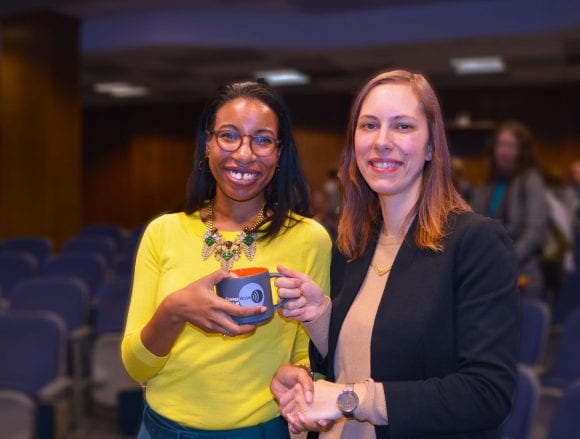
 Cynthia Brewer accepts the O.M. Miller Cartographic Medal from the American Geographical Society, with Marie Price, AGS Council president, left, and Christopher Tucker, AGS Council chair, right. See the feature story,