
Photo by D. Sillman
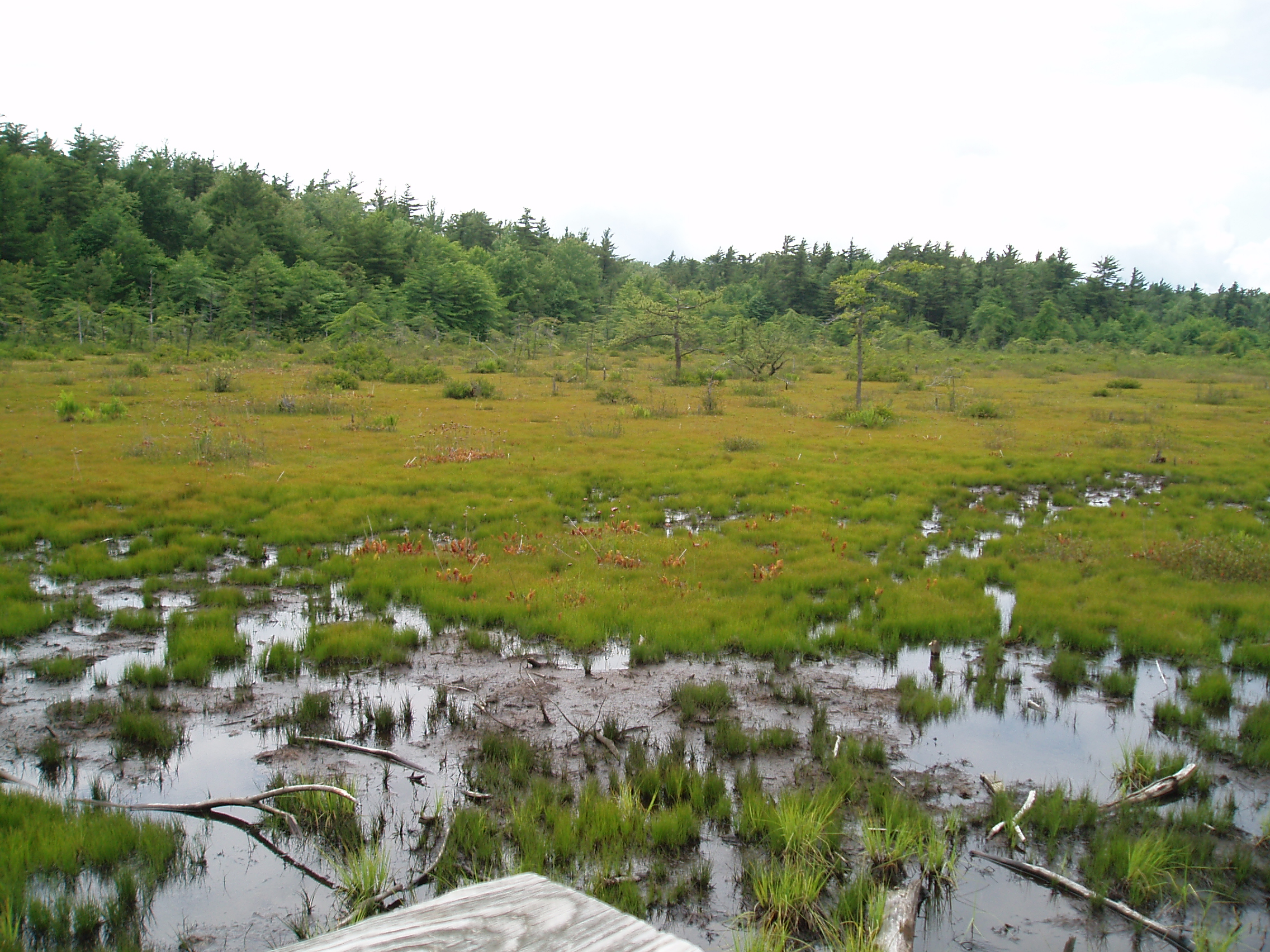
The visual image and history of the Spruce Flats Bog are important (to the left is a summer picture of the bog). First, like the top of most of Laurel Hill, the overall topography of this site is remarkably flat. Also, like most of the top of Laurel Hill, the rock underlying this site is a thick, hard, water impermeable layer of sandstone that is covered by only a very thin layer of soil. This underlying sandstone spreads out under the Spruce Flat Bog area in a broad, shallow, saucer-shaped pan that tends to accumulate rain water and snow melt. The formation of this depression may have been caused by the weight and movement of a ridge top glacier that formed during the last Ice Age tens of thousands of years ago. The great continental ice sheets of this Ice Age terminated many miles to the north of here, but the locally cold climate they generated and the high altitude of this ridge (2720 feet) may have combined to support an isolated mass of ice. Retreat of the continental ice sheets and the warming of the climate would have melted the ridge glacier leaving behind a broad, shallow lake that then began the slow process of pond succession and transition into increasingly solid land. Simply visualized, the pond slowly filled with vegetation and sediment, and its water tolerant plants were slowly replaced by more truly terrestrial plants that began an incremental march in from the edges into the slowly solidifying center. So, this area of open water became a bog, and then a peaty-soiled wet forest, and then, as larger and larger, more rapidly transpiring trees became established, it eventually became a dry soiled forest in which the rates of water accumulation into the saucer were balanced by the outward (and upward) transpirational loss of water by the standing trees. To have looked at this site in its forest form, the potential for a bog would have been very difficult to see!
In 1908, the virgin hemlock forest on this site (and “hemlocks” were frequently mislabeled as “spruces.” Hence, the very odd name for this bog!) was cut. Following this logging, a fire burned away the slash, the re-grown shrubs and sprouts, and also much of the humus-rich upper soil layers. The site now lacked both the sponge-like organic soil materials and also its ecological “pumps” (the transpiring hemlocks). So, rainfall and snow melt once again began to accumulate as free water in the saucer shaped depression. A shallow pond formed followed by a repeat of sediment and vegetation accumulation to form a bog. The inability of trees to grow on the site and the uninformed opinion of the worthlessness of wetlands led to attempts to drain the bog. Dynamite allegedly was used to try to fracture the underlying sandstone and allow downward flow of the bog water into ground water, but the pond/bog persisted. The donation of the land to the state and the creation of the state park protected this bog (although in other state park areas other bogs have not been so fortunate).

Photo by D. Sillman
In the 1950’s pitcher plants (a summer photo of these pitcher plants is to the left) were transplanted into the bog by members of the Botanical Society of Westmoreland County, and other wetland plants (like sundews) were also, undoubtedly, introduced into the site at this time. The bog contains cotton grass, cranberry, blueberry, white cedar, pitcher plants, and round-leaved sundews. Sedges grow profusely across many areas of the bog and Juneberry shrubs line the edges of the boardwalk that connects to the observation platform that was built by the Pennsylvania Conservation Corps and Youth Conservation Corps in 1995 and 1996. Conifers (including white pine, pitch pine, Norway spruce, black pine, and eastern hemlock) have been planted around the circumference of the bog forming a tall, green, wall-like palisade on the high edges of the great depressional saucer. Some of the white pines are extremely sculpted by the strong west to east prevailing winds and have grown into fantastic, “action-shaped” morphologies.
We walk down the flat, level, and evenly graveled path and in ten or fifteen minutes are standing on the boardwalk that extends out over the shallow water and wet soil. Even in the cold air of the fading afternoon I can smell the richness of the bog. The scent, a combination of rich organic muck, water, and hydrogen sulfide, pours over me and triggers a cascade of old (and very good!) memories of coastal wetlands and hours spent mucking and kayaking through them. We have the two golden retrievers on leash so that they don’t go off splashing in the bog muck. Izzy is tired and sticking with us, so we leave her off her leash. She takes a short walk into the edge of the bog but comes back to dry land quickly.
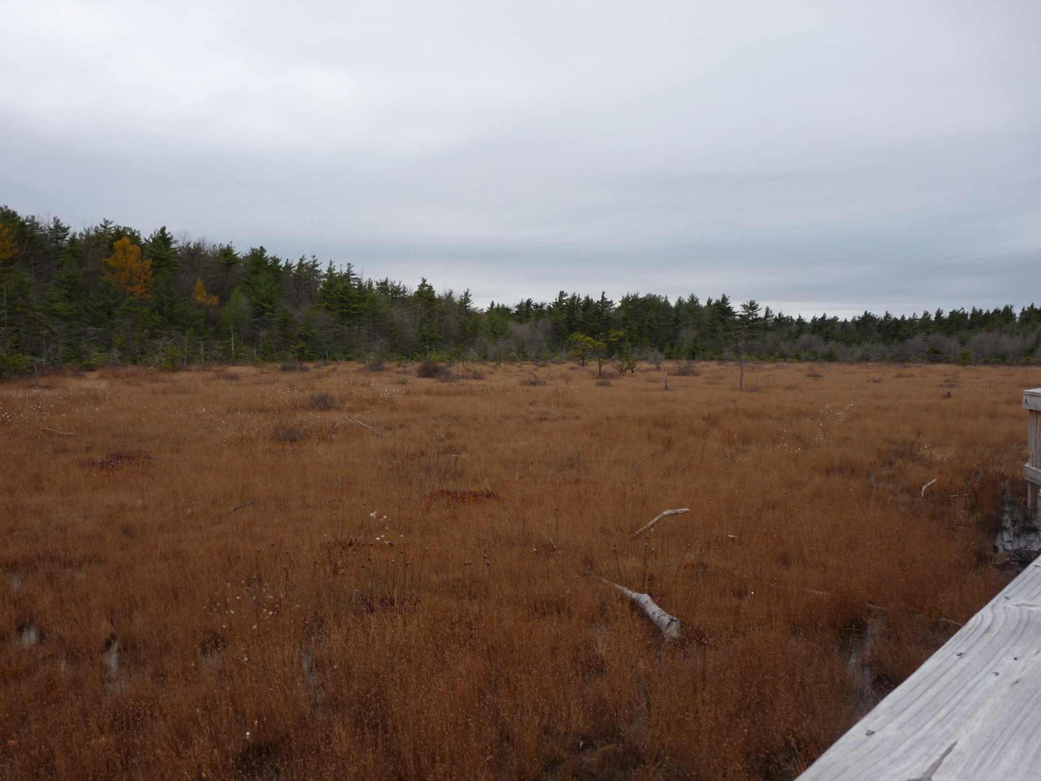
Photo by D. Sillman
The brown, dry tops of cotton grass spread out over the surface of the thick, black water. Scattered cedars of various sizes and ages stand like islands in the sea of dry grass. You can picture these little cedar islands slowly expanding as the vegetative debris steadily builds up a peat layer into which more and more rooted plants can grow. We also see sphagnum moss growing in from the edges of the bog. Its slow growth and steady accumulation will be another major player in the inevitable re-transformation of this wetland into a solid, richly organic saucer of soil. Scattered in clumps of cotton grass and sphagnum are the red “pitchers” of last season’s pitcher plants. The chambers of the pitchers are designed to lure and trap insects in an enzyme rich fluid where they will be slowly digested to harvest their body nutrients.
Insectivorous plants of the bog (like the pitcher plants) are evolutionary solutions to one of the fundamental nutrient problems of wetlands specifically and wet soils in general: the lack of nitrogen. Nitrogen is a vital nutrient needed for plant growth. Nitrogen in soil is available to plants either as ammonium ions (NH4+) or as nitrate (NO3-). In very wet soils, oxygen levels are often very low due to the inability of air to penetrate into the water filled soil profile. Anaerobic bacteria in the soil then use nitrates as the final electron acceptor in their energy metabolism instead of oxygen. This bacterial generated reduction of nitrate (which is called “denitrification”) generates nitrogen gas (N2) which then leaves the soil and joins the incredibly abundant nitrogen gas reservoir in the atmosphere. So, when a soil is very wet and anaerobic, it is also almost always deficient in nitrogen. The pitcher plants and also the sundews (which we have seen here in the summer but which are not visible here on the cusp of winter) harvest nitrogen from their ensnared insects to help fuel their growth and reproductive metabolisms
After a long hike in the confines of the woods, standing on the edge of the open expanse of the bog is peaceful and welcoming. The wind, though, is picking up and the temperature is continuing to fall. The dogs lie down on the planks of the boardwalk and leave behind perfect, muddy outlines of their legs and bodies. We are going to have to find somewhere to clean these guys up before we go back to Rob and Michele’s condo in Hidden Valley! We leave the observation platform reluctantly but with even more pace to our walking speed. It is getting dark when we get back to the cars. The soft car seats and the quickly warming heater feel unbelievably good! Definitely a sign of winter!