
(I have been saving these next two posts for the winter. Let’s all enjoy the color green for a while!)
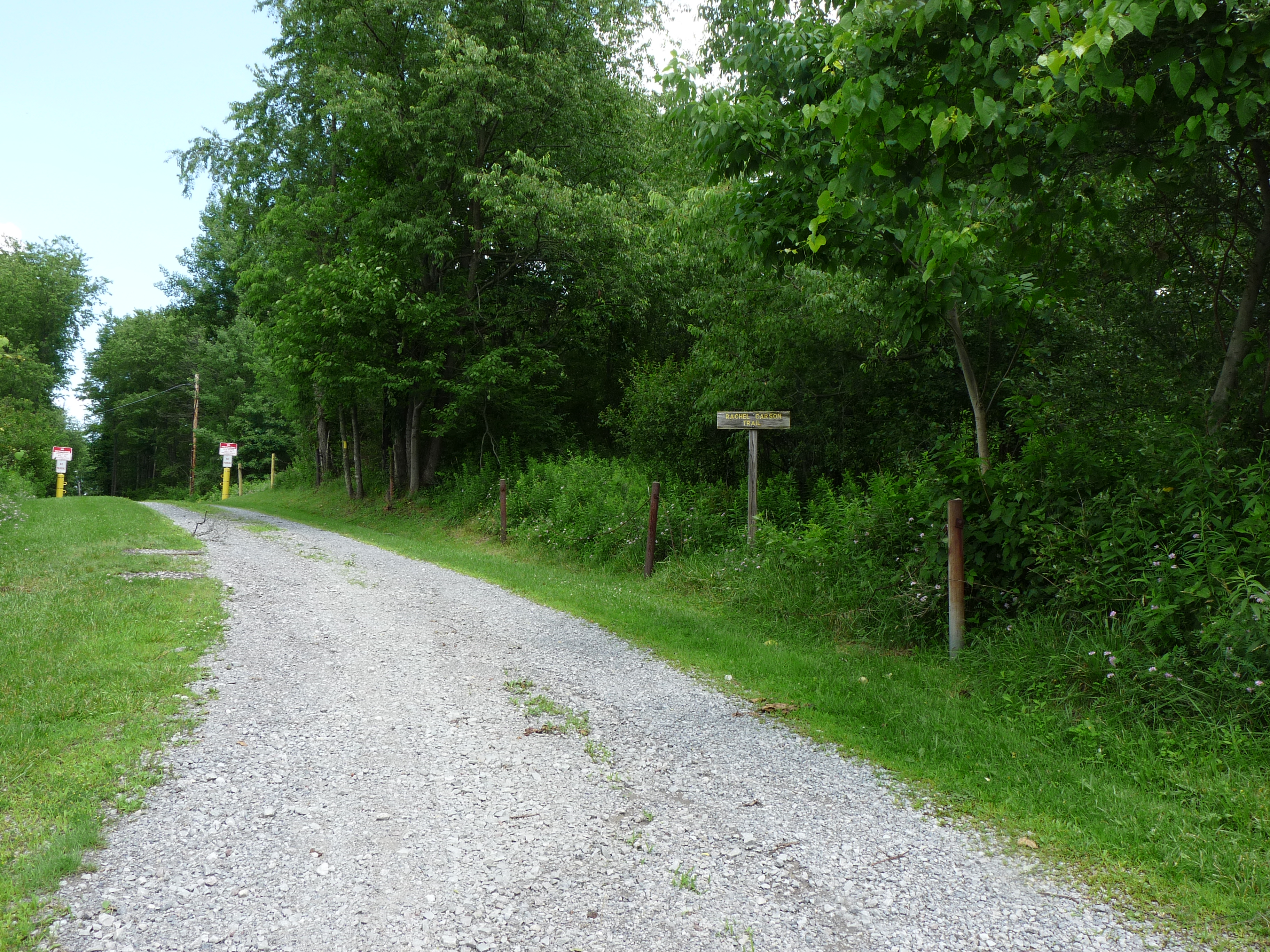
Photo by D. Sillman
The Rachael Carson Trail starts as a straight uphill climb from Freeport Road on the north edge of Harrison Hills Park. We park across the street, dodge our way across four lanes of traffic, and then walk up the gravel road/driveway that winds up toward a large cell phone tower. The sign announcing the trail is relatively new and unweathered, and the narrow road (or broad driveway?) has only a few signs of damage from the recent heavy rains. The blazes for the trail are yellow, and they are also fresh looking and clearly positioned.
The trail follows three sides of a tall, chain link fence that surrounds the cell phone tower. Signs prohibiting trespassing are prominent all along the fence line. The fence is not electrified but looks as if it could be! We keep the fence to our left and a dense mass of ecotone vegetation (dominated by poison ivy) to our right.

Photo by D. Sillman
The trail heads off to the right away from the tower and dips down into a muddy rut. You have to choose to either walk in the mud or brush against the edging vegetation. Again, poison ivy is the dominant species here along with raspberry, blackberry and multiflora rose, so avoiding the urishiol and the thorns seems like a good idea. Boots and socks get soggy quickly.
Very soon, though, we break out of the dense vegetation and climb up onto the dry, open oak forest that runs along the top of the cliffs on this west side of the Allegheny River. The river far below is chocolate brown from all of the recent rain and runoff. It is also running very high and fast. Signs along the trail caution everyone to watch the drop off! We are at eye level with the vultures that frequently soar along the river.
The path follows the contours of the ridge down into gullies that are bottomed with rocky streams and then back up again. The rocks are slippery with mud and silt, and swarms of gnats and (probably) mosquitoes hover over the water.

Photo by D. Sillman
Mushrooms are everywhere! Orange and red and yellow and brown, small button shapes and larger “toadstool” shapes, cones and goblets, and great, free-form lumps of tissue. The incredibly wet past month has triggered all of the soil fungi to make their mushrooms all at once!
Indian pipes are up, too. Older pipes have opened up their tops in a flower-like profusion while the newer pipes still have their dangling tight shapes. We hiked along here a week ago and only saw young
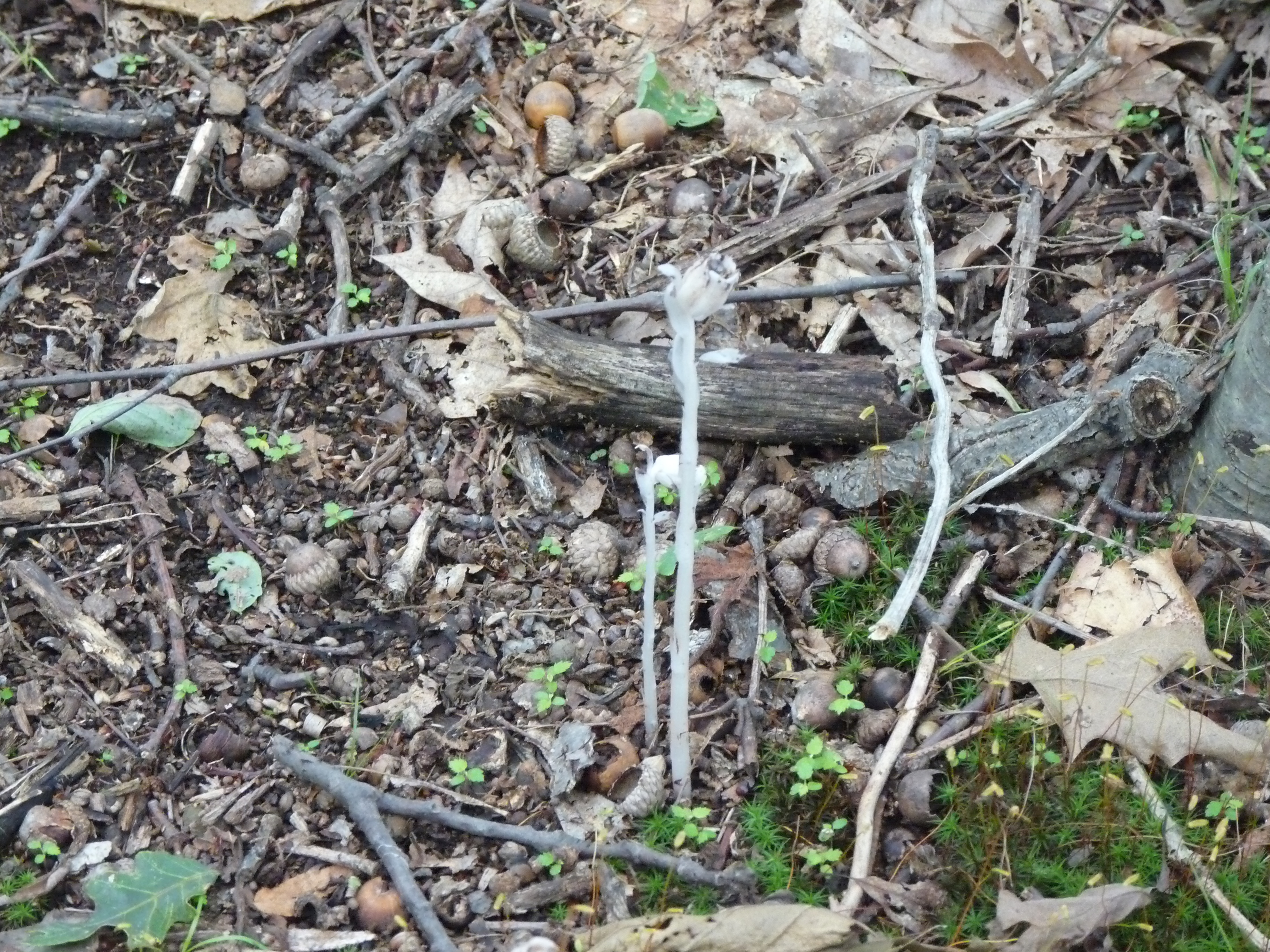
Photo by D. Sillman
pipes, now we mostly see the opened shapes.
We scare a deer up from a woody hiding spot down off the trail. She goes leaping off through the dense underbrush and disappears down a hollow in series of crashes and snapping branches.
The streams driving down the steep slope to the river have cut deeply into the underlying rock. They tumble in short waterfalls over larger rocks and zig-zag around the standing arrays of smaller ones. The rocks are swept clean of any soil or silt. They are being continuously polished by the flowing water.
Along the trail oak seedlings (mostly chestnut and white oaks) grow in profusion. They are a foot or two tall with apical clusters of huge leaves.
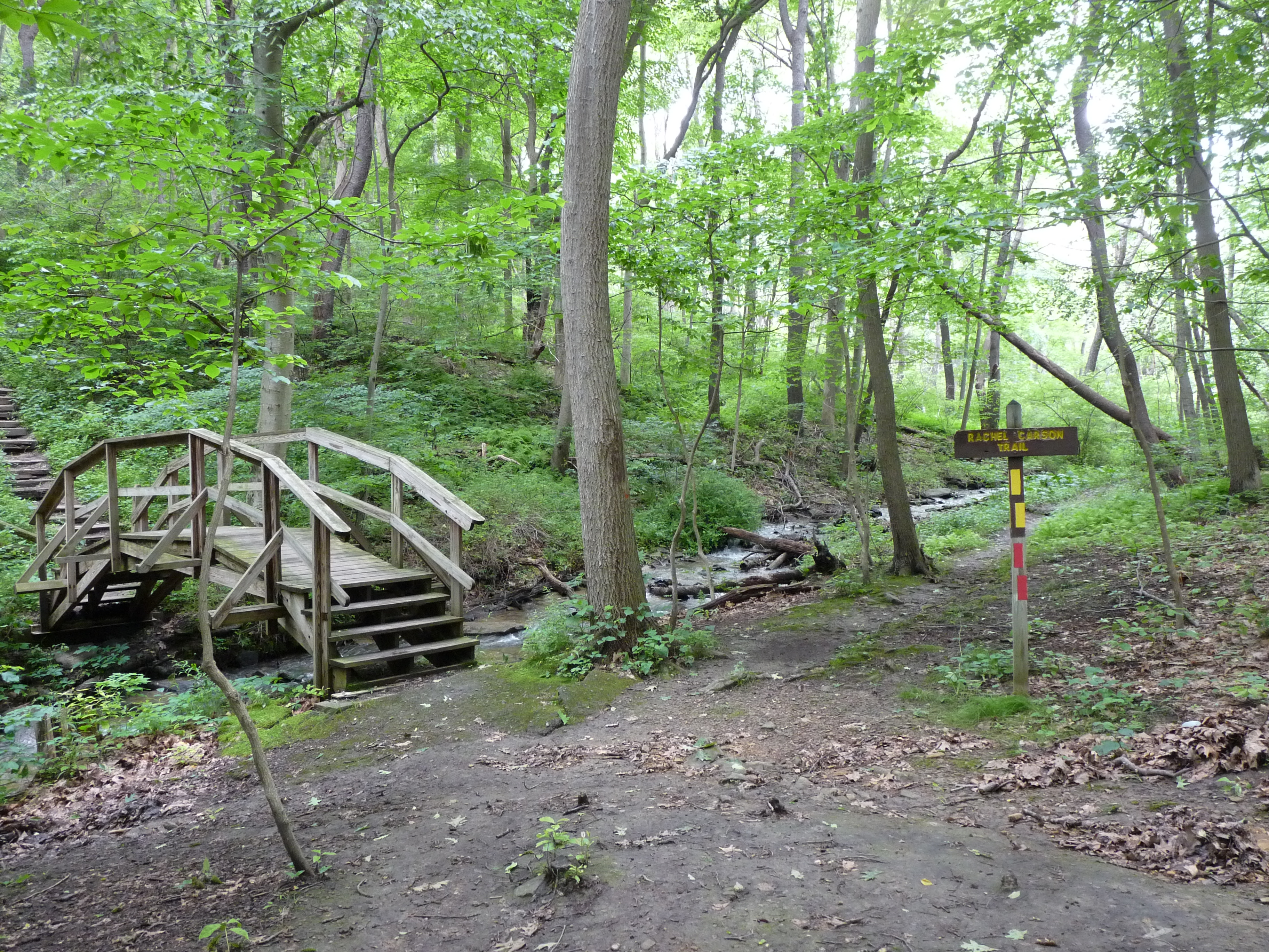
Photo by D. Sillman
In places there is an inch or two of flowing water on the trail and we have to step out into and on the surrounding vegetation. We keep a close eye out for poison ivy but have to walk where we can. We cut across the large playground and parking area and re-enter the woods. We walk over the arching, wooden foot bridge and turn right to follow the yellow blazes. After a couple of dozen yards we come to a large, black cherry tree that has fallen across the trail.
The tree has fallen in the last week. We walked this section of the trail the previous Monday and had no impediments. The violent thunderstorms of the intervening weekend probably took it down. The tree is about two feet in diameter and extends far off the trail in both directions. So, there is no choice, we either go over it or turn back. We climbed up over the first part of the tree and get ready to slide down and crawl under the second part when we notice that not only is the tree trunk on which we are perched covered with poison ivy vines but that I am holding onto a “branch” for balance that it actually a woody extension of one of the intertwined poison ivy vines that encase the entire tree. There is nothing to do by go on and we crawl down off the first trunk and under the second.
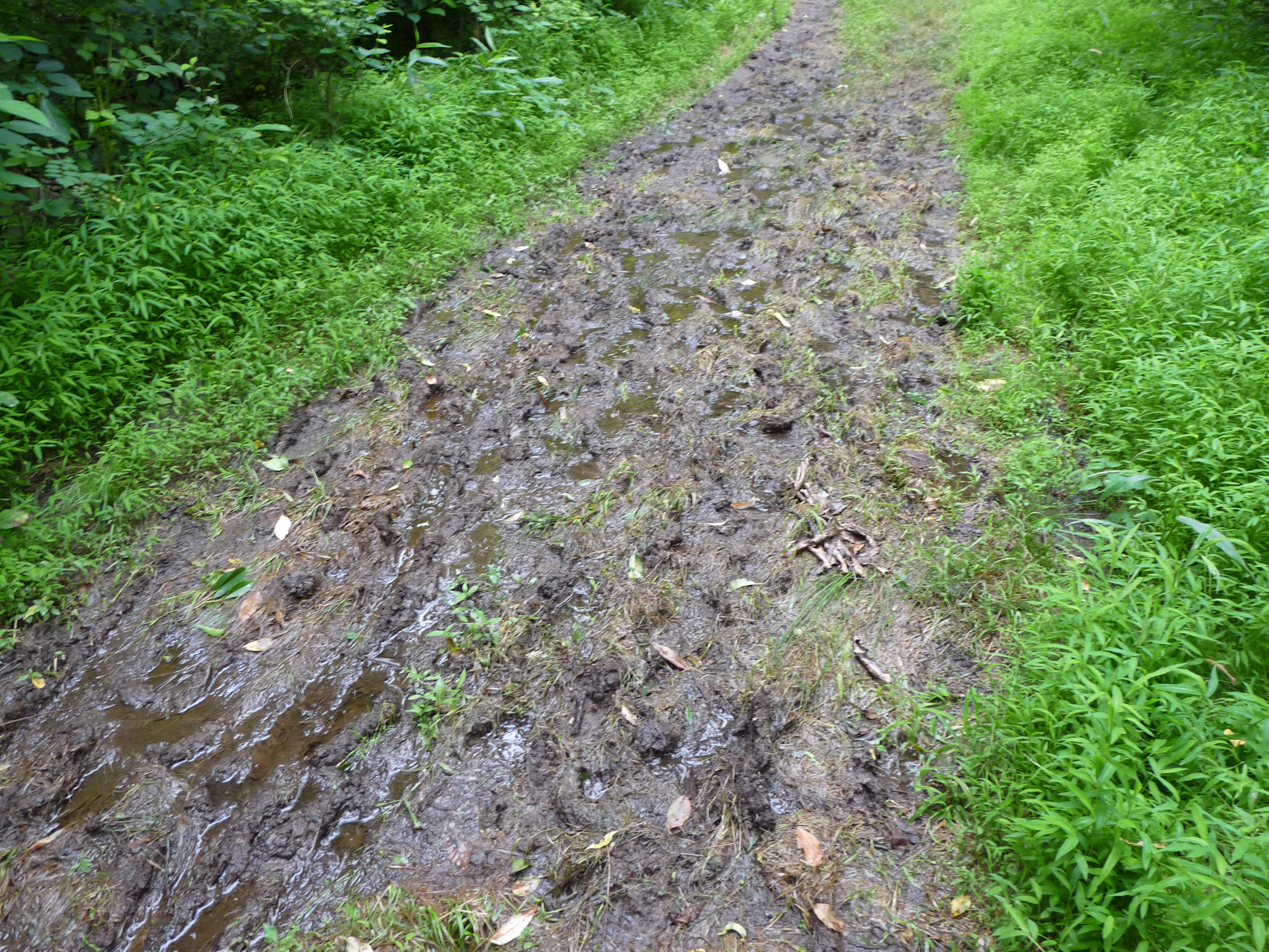
Photo by D. Sillman
There are three more black cherry trees down across the trail ahead and we climb and crawl over them trying to keep from touching our faces with our possibly urishiol covered hands. Deborah walks ahead and gets a covering of itchy spider webs across her face but leaves them there.
We have about a mile more to walk and after some more mud and slipping and sliding (and a downpour of unexpected rain) finally see the car in the parking area.
(UPDATE: neither Deborah nor I got any poison ivy from our above encounter, and I really can’t explain why! Next week: Part 2 of this hike!)