
by Tara LaLonde, GIS specialist
During Geography Awareness Week (November 16-20, 2015), multiple events provides students, faculty, staff, and community members the opportunity to explore maps! Over 100 participants engaged with one another on the power of maps. GIS Day events were co-sponsored by the University Libraries and the Department of Geography. Monday’s mapping workshop and Wednesday’s morning and afternoon speaker sessions were also part of Global Entrepreneurship Week.
Highlights included:
- Mapping Applications: Getting to know SimplyMap, PolicyMap, and Social Explorer (11/16/15) demonstrated to students the many datasets available from these applications. Participants explored the differences and similarities of options for map design and output from these library subscribed applications.
- GIS Day (11/18/15) elevated the presence of geospatial information and analysis occurring on Penn State campus and beyond. During the information fair, participants interacted with many Penn State geospatial groups and programs. They were able to exchange information and get resources to further their exploration of geospatial information. We were thrilled to be joined by multiple groups outside of Penn State. The National Weather Service (State College, PA), Here maps, and ESRI joined us in the Information Fair and provided valuable information to visitors. Attendees also were able to view posters related to GIS topics in the Franklin Atrium.
- Joseph Kerski, Esri Education Manager, gave two engaging talks to audiences in Foster Auditorium. His first talk focused on why geotechnologies matters, and his second talk focused on ArcGIS Online storymapping web applications. Here maps presented on the many uses of Here maps and how their maps are developed and maintained. Multiple Penn State students and faculty members participated as lightning talk speakers. We learned about Openstreetmap, Sanborn land use code creation, hazards data, uavs, and more. Afterwards, participants were welcomed at a reception to learn more about geospatial interests from one another. Karen Schuckman (Department of Geography) was the recipient of the raffle drawing for the prize of a $75 Amazon gift card contributed by Geographic Research Inc.
- Recordings of Joseph Kerski’s talks, Here maps, and lightning talk presenters are available on Media Site Live: Morning Session: Joseph Kerski, Lightning Talks and Afternoon Session: Here maps, Joseph Kerski, Lightning Talks
- OpenStreetMap Mapathon (11/19/15) enabled students and participants to learn how they could map to benefit a community. Participants digitized outlines of buildings for a portion of Dar es Salaam, Tanzania (http://tasks.hotosm.org/project/1345) and experienced mapping in a hands-on environment. This OpenStreetMap Mapathon was coordinated by Aaron Dennis, Department of Geography.
Thank you for making this year’s GIS Day a success. We look forward to future GIS events.

The reception included a display of a State College, PA hand-drawn map by Michael Sutherland, Department of Geography. — all photos by Wilson Hutton
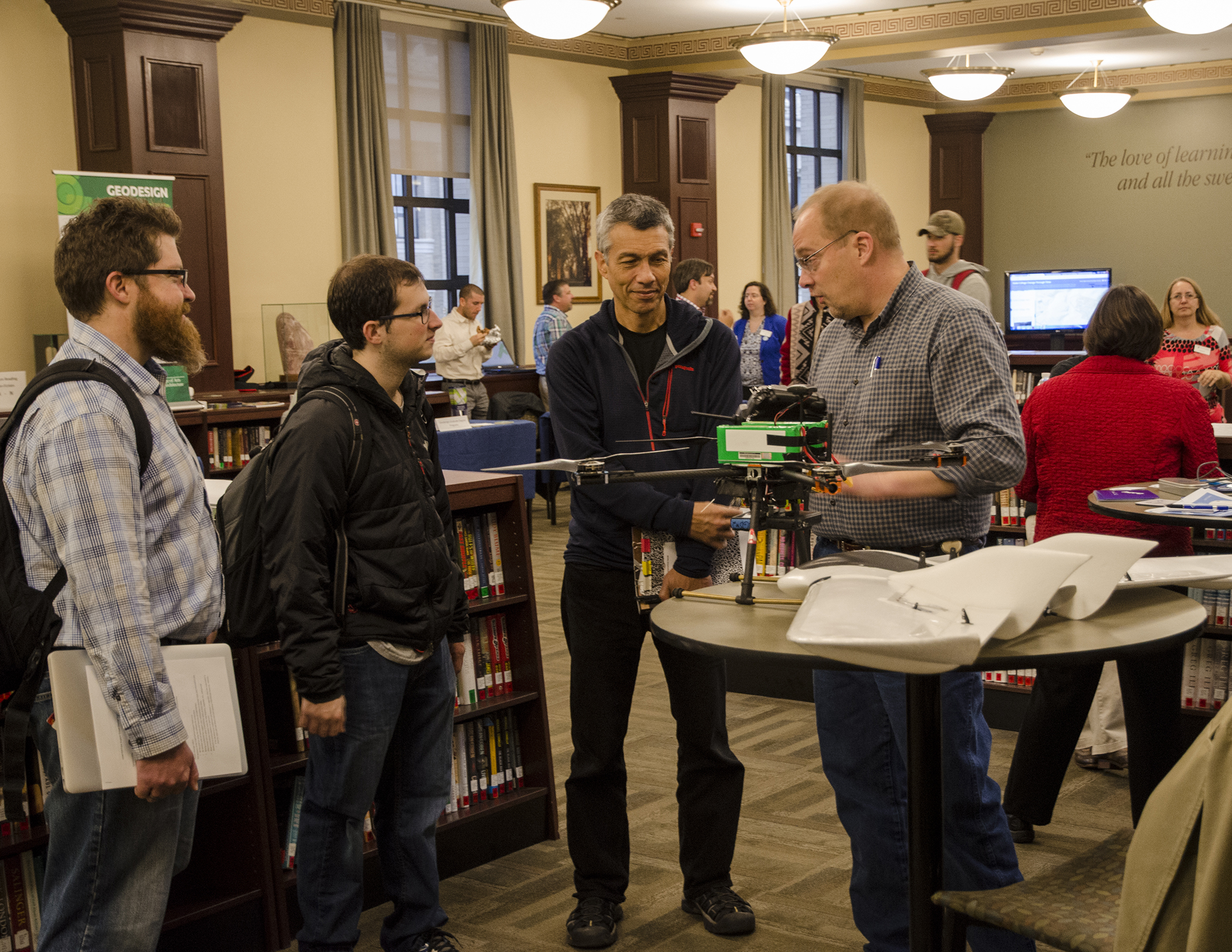
Information fair participants sharing geospatial information
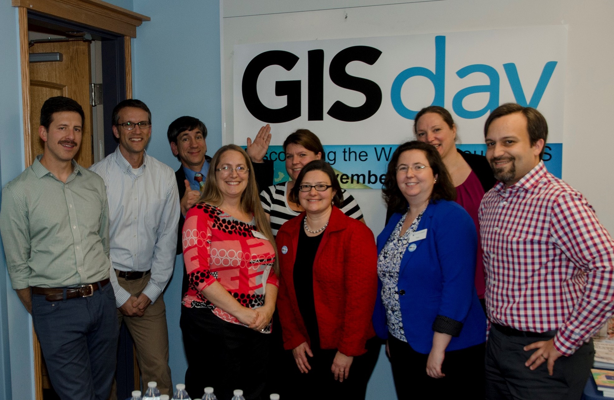
The GIS Day planning committee with GIS Day speaker, Joseph Kerski, ESRI Education Manager