Esri provides basic and free instructions for those who are new to ArcGIS Online through the training website. To access the training website, go to https://www.arcgis.com , sign in (If you are a Penn State Student, enter pennstate as the organization URL), go to the top right of the corner and click your Account, then click Training. From here, you can find free or paid courses for ArcGIS Online. Under the Getting Started heading, you can click to the right until you find the ArcGIS Online Basics course. Click Launch Course.


You are greeted with an introduction to ArcGIS and presented with Goals and Software Requirements. Make sure you have an ArcGIS Organizational Account such as a user account (Penn State Students have access with their email). Once you have verified all of the information in the introduction, you can start on the first of four modules that are in this lesson. In each of the modules, you will be tasked with a quiz at the end. The first module introduces the ArcGIS Online components, which explains the different levels of sign in options such as public user, Organizational Member, or social login. It gives a broader definition of ArcGIS Online as a Software as a Service (SAAS) Model that allows users to create and share geospatial information to their organization through the cloud.
In the second module, you will be introduced to the different content types on ArcGIS Online: Layers, Maps, Scenes, Apps, and Files. With layers, you will learn how there are Basemaps, which are static tiled layers that provide the geographical context for a map, as well as Operational Layers, which is the imagery or features laid on top of the basemap. Operational layers can be added from a local file or searched with ArcGIS to create a map that displays attribute info and has the potential to be spatially analyzed. After this, ArcGIS will showcase the layer types commonly used in their software: Feature Layers, Tile Layers, Map Image Layers, Imagery Layers, Elevation Layers, Scene Layers, and Table Layers. In this basic course, you only need to know these definitions and identify where they are found on the example maps that ArcGIS takes you through, but they are highly important because almost all maps use these layers in one way or another. To test your knowledge of Basemaps and Operational Layers, you are given a matching table with layers found on an example map to the right and need to match them with the layer function (Operational or Basemap, in this case). Once completed, the tutorial asks you to navigate to an example of an item found using the search tool. Once you find this map, you learn where to find authors, date, the sources for the layers, and the map itself.
Module Three begins with explaining where layers come from, such as a file you upload, files already on ArcGIS, or a sketch. At this point, the module takes you around the Map Viewer and details how layers interact with the Basemap in the Sierra Nevada Mountains. After this, you will learn the different levels of sharing and the different scenarios where you need to change the share settings. It is a relatively short and simple module.
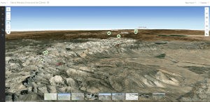

The final module gives the user insight to the capabilities of ArcGIS Online: Smart Mapping, Analysis, and Sharing. ArcGIS takes you to another training map, but this time it is a 3D Scene of the same mountains you previously looked at. This is when Groups are introduced, which help determine which level of sharing you should have based on the map’s purpose. In the case of the Sierra Nevada Mountains, you are shown the capabilities of creating a Web App, which provides users with greater interaction with a Web Map. You are tasked with creating and previewing an Interactive Legend app for hiking trails, which allows filtering of areas that are climbs or descents.
Once you complete all of these modules, you receive the ArcGIS Online Basics certificate.

Nathan Vincent is a Sophomore from the Lehigh Valley majoring in Geography in the college of Earth and Mineral Sciences. Nathan’s interests include Land Use, Transportation, GIS, and Information Technology. Nathan has been working at the Donald H. Hamer Center for Maps and Geospatial Information since April 2023.
Leave a Reply