As we enter November, it is important to acknowledge and celebrate American Indian and Alaska Native Heritage month. Within our own map collection and within the Big 10 Academic Alliance, we have access to several maps and important historical information that highlights the Indigenous presence in the U.S.
The European settler’s concept of ‘Manifest Destiny’ caused the pushback of Indigenous populations westward for several hundred years. There are two main ways the Europeans gained this land: treaties and cessions. This map of Pennsylvania depicts the alleged treaties in which the Native tribes ceded land to the settlers. It is very interesting to see some of the Indigenous place names, while we can also see some current day place names like counties.

This relief map by the U.S. Department of Interior and U.S. Geological Survey indicates the Native tribes residing in current-day Washington State. It was made in 1876. I think it is interesting to see the names Seattle and Tacomac, where the names of the cities come from.

This map highlights the Indigenous and French influence in the state if Indiana, as the name comes from the inaccurate term ‘American Indian’. There is also a map of ‘Indian’ treaties which opened up the land to settlers.
This historical map made in the late 19th century highlights the presence of Cherokee, Creek, Chickasaw, and Choctaw Nations in present day Oklahoma. It is important to note, however, that these four nations along with the Seminole nation were forced to flee their land east of the Mississippi River in 1938 during the Trail of Tears. This was part of Andrew Jackson’s ‘Indian Removal Policy’ and caused significant devastation. These tribes then settled in current day Oklahoma.

It is important to note that these maps were made by European cartographers, and the borders may be somewhat disputed. I would recommend clicking the in-text links in order to zoom in on these maps and explore further.
Another great resource, although not from Penn State or the Big 10 Academic Alliance, is Native Land Digital. They are a Canadian not-for-profit organization led by members of the Indigenous community as well as several Native contributors. According to their website, “Native Land Digital strives to create and foster conversations about the history of colonialism, Indigenous ways of knowing, and settler-Indigenous relations, through educational resources such as our map and Territory Acknowledgement Guide. We strive to go beyond old ways of talking about Indigenous people and to develop a platform where Indigenous communities can represent themselves and their histories on their own terms. In doing so, Native Land Digital creates spaces where non-Indigenous people can be invited and challenged to learn more about the lands they inhabit, the history of those lands, and how to actively be part of a better future going forward together.” On their interactive website, you can see different layers that include Native Territories, Languages, and Treaties around the world.
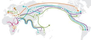
Although we mainly think about Indigenous people in current day North America, it is essential to think about native people throughout the whole world. Other indigenous tribes throughout the continents are highlighted in this interactive map.
Acknowledging the cultural significance and the hardship endured by these communities is the first step to a better future. There are other movements working towards equality, like LandBack, the Dakota Access Pipeline Protests, as well as several initiatives for racial and economic equality.
Dall, William Healey, 1845-1927.,Powell, John Wesley, 1834-1902.,Geographical and Geological Survey of the Rocky Mountain Region (U.S.). (n.d.). Map showing the distribution of the Indian tribes of Washington Territory. https://quod.lib.umich.edu/c/clark1ic/x-000889503/39015091914450
Geological Survey (U.S.). (1902). Indian territory. https://collection1.libraries.psu.edu/cdm/ref/collection/maps1/id/30368
Landback. LANDBACK. (n.d.). Retrieved November 3, 2021, from https://landback.org/.
Public Broadcasting Service. (n.d.). The trail of tears. PBS. Retrieved November 3, 2021, from https://www.pbs.org/wgbh/aia/part4/4h1567.html.
Standing Rock Sioux and Dakota Access Pipeline: Teacher resource. Standing Rock Sioux and Dakota Access Pipeline | Teacher Resource. (n.d.). Retrieved November 3, 2021, from https://americanindian.si.edu/nk360/plains-treaties/dapl.