Tag Archives: Fieldwork

Fieldwork Blues

PSU Geography Japan

Penn State Geography, Japanese Alps

The hiking has been amazing.  Over the past two weeks Helena and I have been doing lots of hiking and though not all of it is far in distance (46km) there has also been a major elevation component (gain 5196, loss5246).  Each trip into the mountains begins with a roughly 1300m vertical assent over 4-6km.  So far Helena and I have made it to the top of 4 mountains (Tsubaroku, Jonen, Yokodoshidake, and Chogatake) in addition to a number of smaller hills and what felt like mountains in between.

Tsubakuro Peak

Peak of Tsubakuro

Chogatake Peak

Peak of Chogatake

Jonen Peak

Jonen Peak

Panorama_Yari_Tsubakuro

Panorama from near the Enzanso Hut on Tsubakuro

Presunset_Jonen_Yari

Pre-sunset from Jonen Peak across the Hotaka complex and Yari

The views from the peaks of these mountains and from the adjacent campgrounds have been amazing.  Our days are bookend by amazing sunrises at 4:45 and sunsets at 7:10.  However, we are not in the mountains to hike we are in the mountains to work.

Tsubakuro sunrise 3

Sunrise from our tent at Tsubakuro Enzanso Campground

Sunrise on Mountains

Sunrise Panorama from the campground at Tsubakuro Enzanso Hut.

Sunset_Jonen

Sunset from Jonen Goya (Hut)

Working in the mountains has had a number of false starts.  Initially we were limited in our work due to waiting on permits to come through.  Once the permits were all dotted and crossed we were able to begin working in the mountains, however, the leaves on the trees were not yet flushed.  Why is this important?  One of the aspects of my research is to examine the regeneration niche of seedlings throughout the forest and a key component is the light availability at ground level.  If the leaves have not fully opened (flushed) than there will be more light available than when the forest canopy is fully developed.  I am trying to measure the fully developed canopy light environment using hemispherical photography.

Norikura_flush

Snow on Norikura with birch leaves opening in the background, those in the foreground have yet to burst.

While waiting for the leaves to fully flush, Helena and I have headed to the mountains to assess the research sites and to core trees for the climate portion of my study.  Here, we have run into another problem, steep slopes.  While I knew some of my potential study sites would not be appropriate for my research, I did not expect the east slope of most mountains to be inappropriate.  When I say inappropriate it is not due to the species composition.  There are very nice forest belts from the sub-alpine forest, through the birch and up to the Haimatsu (creeping pine) belt.  These sites are inappropriate for they are too steep for safety.

Hiking in Haimatsu

Helena hiking through haimatsu

Jonen Poor

Poor east and west facing slopes at Jonen.

Most recently we hiked down what appeared to be a steep but not too steep slope on Chogatake, only to find that it was too steep.  Having climbed down from the Haimatsu belt to the Sub-alpine forest we realized that the slope was really a series of small cliffs and exposed meadows.  Hiking up the meadows was not feasible for there is no shrubs to hold onto so we climbed up the slope and small cliffs back to the top.  On a number of occasions we measured the steepness of the slope which was 60-70 degrees!  Thus the slope is too steep and not appropriate.  These slopes are hard enough to walk in let alone attempt to do field work.

Jonen to Chogatake

Jonen Peak towards Chogatake shows how steep the east (left side) is compared to the west (right side).

Chogatake Slope

Dangerously steep slope on Chogatake

Tsubakuro study sites

Tsubakuro Study area with the beautiful peak of Yari in the background

 All of this has led me to reassess and discuss my proposed fieldwork and how to continue to make progress towards completing my research, while doing it in a safe manner.

Permits

In preparing for the field season one of the main tasks has been to navigate the Japanese Government Permit system.  Due to my limited abilities in Japanese I am very fortunate to be working with Dr. Koichi Takahashi of Shinshu University who has done the lion’s share of the permitting process.

My main task in this was to determine which mountains I would like to conduct my research and where on the mountain the study sites would be located.  To do this I conducted a site selection in Arc GIS limiting the area within Chubu Sangaku National Park to areas between 2200-2700m, less than 40 degrees slope and by dominant geological stratum (Granitic or Volcanic).  Using this method I narrowed down the potential study sites within the park down. However, I had never been to these mountains so I was not sure if they actually had the forest structures that I have proposed to study.  Using Google Earth, Bing, etc. satellite imagery I tried to examine these mountains to determine if they were appropriate.  However, the imagery for the mountains is nearly always during the winter, thus the hiamatsu (creeping pine) is covered with a thick layer of snow and the kaba (birch) is hard to detect.  After discussing the potential mountain study sites we settled on nine mountains to propose for the research.

Map of Study Mountains.jpg

Map of the nine mountains in Chubu Sangaku National Park/ Northern Alps

Once the mountains were determined the waiting from my side began, while Dr. Takahashi completed the permits form for each of the mountains.  In this process the exact site needs to be located on a map with a photograph of the proposed area.  Additionally, the amount of soils and tree cores to be sampled needs to be clearly stated.

Permits are first submitted to the prefecture Ministry of Environment, in my case I am working in three different prefectures (Nagano, Gifu and Toyama) so permits were sent to each one for the mountains within their borders.  Once the permits have been cleared by the prefectures they are sent on to the National Ministry of Environment.   Permits are then sent to Ministry of Forestry for approval, in highly protected areas, such as those in the Kamikochi area permits need to also be approved by the Ministry of Culture. The permits are returned to the applicant after each ministry has approved or declined the permit and the applicant then sends them to the next ministry. This whole system has seemed to be a large bureaucratic black box to me; however, I know there are many steps to getting an approved permit to do research in American national parks as well.  The difference I think is that both the culture and language are different here, both which typically leave me in a confused state.

After the first full week in Japan I have about 3/4 of the permits with prospects of having the Ministry of Culture permits by the end of July.  Currently I have enough permits to begin working without worrying about the last few for the time being. Things are looking up and the fact that I can write this means the black box is turning grey.

Typical Day

I realize that many of you do not really understand what I have been up to here in Japan.  You realize I am here doing research, at that research in the forest, but what am I truly up too.

I’ll give you an outline of an average day here in Japan.

I wake up around 5:30 when the light starts streaming into my room at the cottage, however, my alarm does not go off till 6:00 so I lie in bed and doze for about 30 minutes until my alarm clock actually goes off.  Then I get up out of bed, fold it up for the day and get dressed in the clothes that I have been wearing everyday in the field.  Before I leave my room if it is not raining I open my window so that the room stays cool through the day and then go down the hall to the dinning area to eat breakfast.

uniform

Horrible picture but it is difficult to take too many self portraits while in the shrubs.  This photo is to show my ‘uniform’ for the summer.  The only official thing about it is my arm band which says something of the sort of Shinshu University Research, I think it says more but I do not know what.  The arm band is great, though frequently I just have it attached to my backpack.  The reason it is great is because it answers many questions of people that see me out and about.

Breakfast is one of two very similar things.  1. Oatmeal or 2. Rice.  The oatmeal is not quite like oatmeal in the USA but it does the job.  On occasion I run out of oatmeal and then I cook extra rice at dinner for breakfast.  Into this grain I add peanut butter and honey.  Though I must say the peanut butter is really nothing like what we eat in the US, it is a source of morning protein.  With this I drink a cup of instant Nestle coffee with lots of milk powder.  I am not really that fond of the instant coffee but the caffeine is nice.  Odd as it might be the Instant Nestle Coffee’s label is in Spanish with a Japanese sticker on top.  Lots of western or American food here is in Spanish.

After breakfast I fill up my water bottles, make sure lunch and snacks are packed.  Then I go to the drying room for my gators and measuring pole before heading for the door.  At the door I put my boots and gators on.  The last thing I do before I leave is say itte rasshai (So long or I’ll go and come back).  Then I start my hike.

The hike to my field sites depends on where I am going, all are easily accessible.  Takahashi Sensei has established 125 plots on Norikura, and he has done so with the forethought that he will not always be young and able but that he will continue to want to study and monitor the forest as he ages.  Knowing this most of his plots is within easy access from either the road up Norikura or along one of the hiking trails.  Most plots are within a 30 minute walk from the cabin.

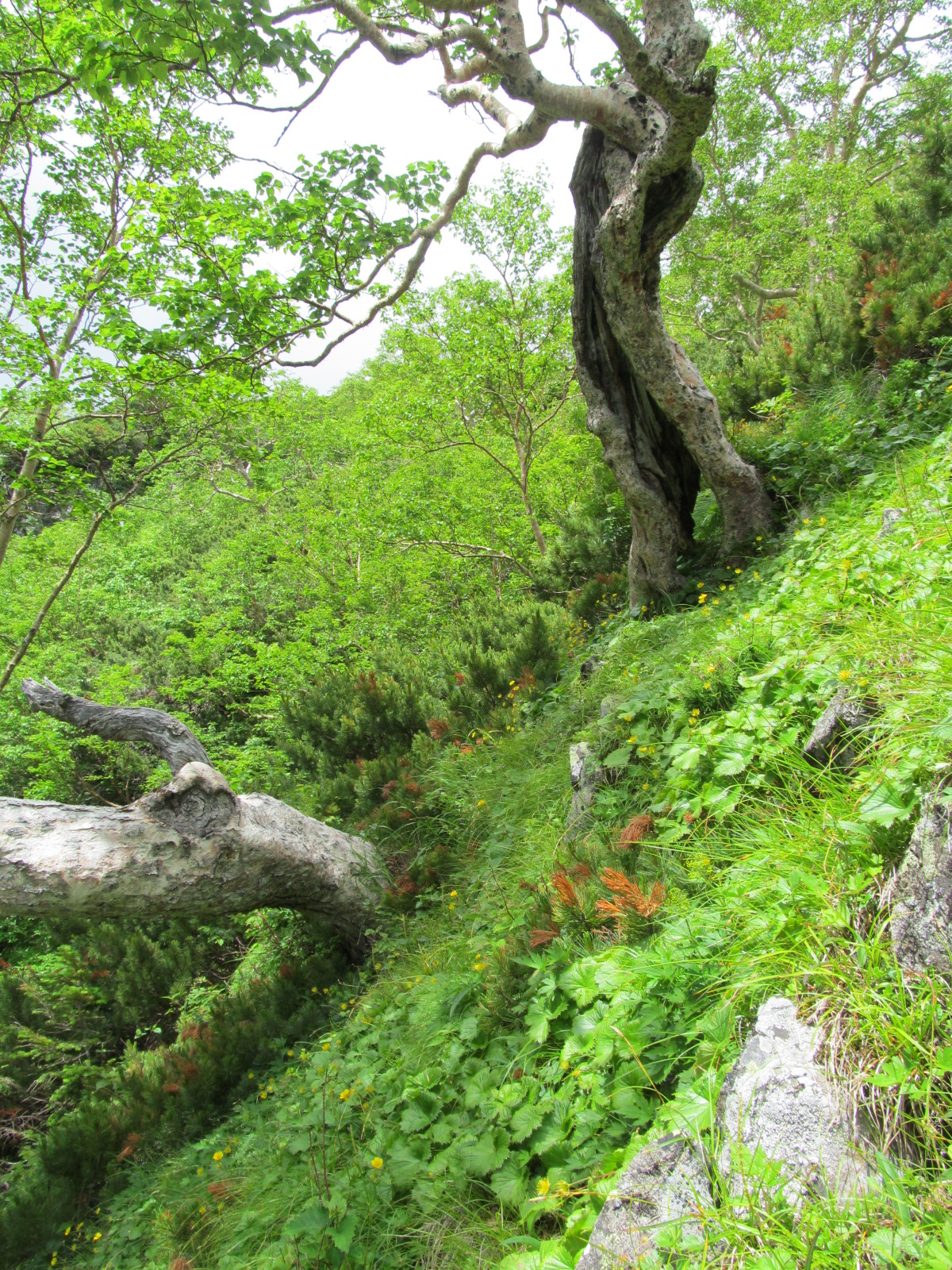
If I am in a Haimatsu or Kaba forest I make sure I am wearing my long sleeves.  This is a precaution not for the bugs, though my collar is normally popped to keep the large horseflies at bay, but for the branches.  My arms are littered with cuts and bruises from walking through shrubs.  Some mornings I do not realize it for it is hot and I have either a tee-shirt or my sleeves rolled up, but after an hour or two of bushwhacking my forearms are either bleeding or stinging from the shrubs.  So, I roll them down or change shirts.  You would think I would remember, but the morning hike is hot.

I have a map of all of the plots as well as their GPS coordinates, though this does not always make them easy to find.   Plots are denoted by ‘number tape’ that is thick flagging with numbers typed on to it, that have been stapled to trees.  Additionally, each plot is 10 x10m in size and at each corner is a piece of PVC piping.  This piping is however, not always easy to find.

For my research I am using point centre quarter methods, which means that I divide each plot up into 4 quarters or segments.  I put a stake (branch with flagging) in at the centre of each plot.  Thus if I can find two of the four stakes I can take an azimuth and find the centre of the plot knowing the proper distance to the middle knowing the proper distance to the middle using Pythagoreans theorem.  So I don’t in truth have to find all of the corners, which is really nice.

 PCQ

Once I establish the centre of the plot, I record the azimuth to the plot in case I need to return, so that I can find the same trees.  Then I attach a measuring tape to a tent stake.  In each of the quarters I measure the distance to the nearest tree greater than 2 meters tall (Kaba and Momi) or greater than 4cm at base (haimatsu).  In addition to measuring the distance to the nearest tree I also record the azimuth to that tree and the distance and azimuth to its nearest neighbor.  That is right trees have neighbors, they are very competitive with one another and try to interfere in each others lives.

TreeMeasure.jpg

The diameter at base and at breast height (1.37m) is measured and recorded for all trees as well as their position in the canopy.  Are they dominant, co dominate, intermediate or suppressed.  Additional parameters are taken from the nearest trees in each quarter such as tree height, height to lowest branches, diameter of crown at it’s widest and perpendicular to that.  Lastly, a tree core is taken from each of the nearest trees that is greater than 4 cm at base.

Now I know some of you know what a tree core is but not all, so let me briefly explain.  A tree core is taken from the tree by using a tree borer (insert photo).  Basically, it is a hollow drill that is manually drilled into the tree.  Once the centre of the tree has been reached a spoon (not a kitchen spoon, but one for this purpose) is use to extract the core from the inside of the borer.  The tree core is then put into a straw and labeled and the borer is extracted from the tree.

Tree Coring

Out of date photo of me coring a tree, this photo is from 2007 in Northern Sweden.  You should be able to get the idea from the photo.  If you know anything about coring trees, please disregard the technique in the photo for I had a broken collar bone at the time and was only demonstrating how to core to my undergraduate assistant.

Though when I write it out it does not seem like it should take that long plots normally take 1-2 hours a piece, sometimes more if I have difficulty in finding the plot or coring the trees or if it raining.

I work until I get hungry for lunch anytime between 10 am and 1pm, then I eat.  Lunch is leftovers from dinner.  Dinner is purposefully made to big so that I also have lunch.  I also have rice crackers, fruit and some candy.  Then back to work.  I keep going until about 6-6:30 in the evening and then I pack up and head back to the cabin getting back around 6:30-7pm.  Before going inside I try to shed as many fir and pine needles as well as twigs off my person, letting my hair down things always fall out.

Upon my arrival I say ‘Tadaima’, which always is a great feeling.  If there are other guests at the cottage I say ‘Kobanwa’ or ‘Konichiwa’ before they start talking to me and I don’t know what they say.  If that happens the cabin owner or his staff tells them to let me go put my stuff down before talking with me.  They know that when I return in the evenings I am exhausted and that it takes a little bit for me to be able to communicate.  Food helps.  If there are no guests I just go about my own business.

I put my measuring pole and gators back into the drying room till morning, change out of my field clothes and go to the dining room.  It’s dinner time, well, it’s time to cook dinner and lunch.  I didn’t really know what people ate in the mountains, and as of yet at the cottage none of the other visitors have cooked their own food they have bought from the cottage.  So what do I eat for two of my meals a day? Basically fried rice, but different than what we would call that from in America.  I cook up rice and put a packet of beans and other grains in with it.  When the rice is almost cooked I cut up some dried fish (I don’t know what kind, but it is good and smoked) and throw it in to hydrate.  When the rice is done, I stir fry some veggies.  Typically, bell peppers and eggplant though sometimes also carrot and zucchini.  The zucchini though does not taste very good the next day so I have stopped that.  When the veggies are almost done I scramble two eggs and put them in too.  Once this is all cooked I mix it into the rice and add a couple of packets of flavoring.  I have no clue what the flavors are but I do like some better than others.  I try looking at the pictures for help in understanding.  If I don’t like the flavor, I’ll add some soy sauce.

Lunch!

Lunch! Dinner only looks different for it is in a bowl and steaming.

That is dinner.  After dinner I clean the pots with paper towels and eat a piece of fruit.  By this time it is normally about 8 pm.  I go back to my room and either read, enter data (not fun) or I do my favorite activity of punching holes into straws.  Yeap, punching holes into straws.  This is so that the cores can dry more efficiently and not mold.  First I take the straws out of their plastic wrappers, then I use a hole puncher to punch holes along the straw.

At 9 pm the generator is turned off and all but emergency lights.  I read with my headlamp until maybe 9:30 or 10 pm and then I pass out till morning to start the routine all over again.

NoriKurra Fieldwork!


Fieldwork!

This past Firday and Saturday I spent up on Mt. Norikura with Dr. Takahashi getting my fieldwork going.  Saturday was a beautifully clear day so I was able to get a picture of me with Mt. Norikura’s peak. 

 Amanda_Norikura

When going into the field on day trips, Dr. Takahashi likes to stop at a 7-11 on the way there and pick up lunch.  The food at 7-11 here is much more diverse than hot dogs, donuts, Slim Jims, chips and candy of the US.  Here you can get sushi, soba, udon, rice balls, rice balls filled with stuff, sandwiches, breads, salads and many other things.  For the most part I have no clue what I am buying but just go for things that seem a reasonable price.  I was not completely thrilled with my choices this weekend but though I would share them with you.  On Friday I had a hotdog bun filled with egg salad (see picture) and a rice ball covered in seaweed filled with caviar.  I am not a big fan of caviar, so I need to remember the kangi for it so that I avoid getting it again.  On Saturday I had this ‘delicious bread’ which was light weight with a thick layer of mayonnaise and corn.  Odd, I know.  I initially though the mayonnaise was cheese but it was not.  I had another rice ball this time I avoided the caviar and ended up with a chicken and vegetable filled ball. 

Egg Salad Hotdog

Corn Sandwich

This weekend’s work was looking at the tree crown structure differences between the upper timberline and the subalpine forest.  Dominated by Fir (Abies mariesii) but mixed with birch (Betula ermanii).  The timberline has the same two species as well as dwarf pine (Pinus pumilla).  In the subalpine forest the trees are primarily vertical in nature, while at timberline the trees are stunted and disfigured due to the snow, winds and lower temperatures.  The undergrowth at the timberline is primarily comprised of dwarf pine, Sorbus (Rowan) and Alnus (Alder).  While the undergrowth of the subalpine forest is more broadly a mixture of Rowan, Alder, and fir seedlings. 

Subalpine ForestSubalpine Forest

Thumbnail image for Timberline ForestTimberline Forest


A couple of pretty shots.  The first is the pealing bark of a birch.  The second is a ‘shojun bangan’ or something like that means hand of something.  Ok not a great description I know.  Besides the Alder and Birch catkins that are opening this is the only plant in flower right now in the mountains.  Many other plants are emerging and opening their leaves, I look forward to seeing the plants develop throughout the summer.

Peeling Birch Bark Shoujoubakama

In addition to this I learned how to take public transport up to my study sites, next week I might get my first chance at it.  Due to the expense of the train/bus I will be staying in a hikers cottage for a couple of nights.  Roundtrip train/bus fair is about $50 so I want to get as much as I can out of each of those future trips.