 Mountaineering is a sport that mixes the pristine beauty of the mountains with harsh, deadly weather, and the rush of adrenaline. Every year, many climbers perish in the wilderness, attempting to reach the summits of rugged peaks. Why would anyone want to risk their life for something so trivial? As the British Mountaineer George Mallory once said, “Because it’s there”.
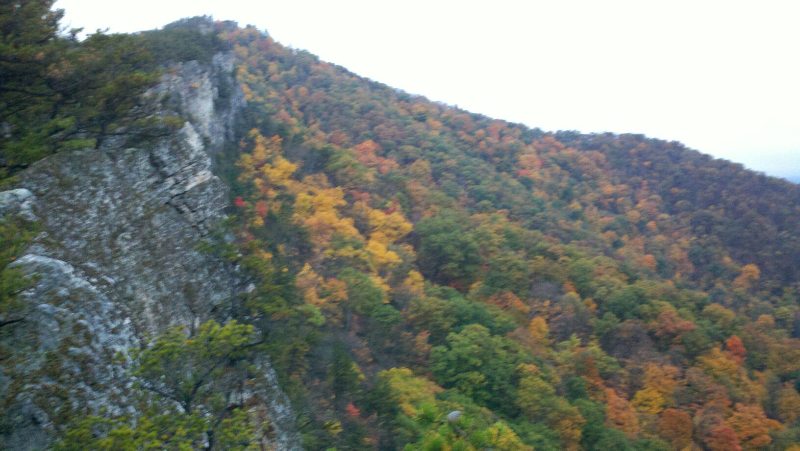
This winter I decided to test my abilities by attempting winter mountaineering in the Adirondack Mountains in New York. The Adirondacks are a subrange of the Laurentian Mountains of Quebec believed to be formed over 1 billion years ago. The mountains are unlike almost any on the East Coast, rising sharply and steeply into the sky from the St. Lawrence Valley. The tiny towns of Lake Placid and Saranac Lake are the only major populated areas in the high peaks region of the Adirondacks, probably because the winters are brutally cold and snowy. During the winter Saranac Lake often has the lowest temperature of any place in the continental U.S.
It just so happened that the week my friends and I decided to go to the high peaks was also one of the coldest weeks of the year, with temperatures rarely peeking above zero during the day and plunging to as low as -27°F at night. We arranged to stay in a hiker hostel in the town of Lake Placid, and we planned to hike 3 of the high peaks. We had hoped to hike Mount Marcy on the last day, the highest mountain in New York State, towering 5,344 feet above sea level. The summit of Marcy lay in the heart of the High Peak Wilderness and hiking it was a 14 mile round trip trek involving over 3,000 feet of elevation gain and a mile long exposed rock scramble to reach the summit. Marcy would certainly be a great feather in our cap if we could make the arduous ascent.
On January 5, I packed my skis, snowshoes and all the warm clothes that I owned into my mom’s minivan, picked up a few friends and began the seven hour drive northward. When we left Philly the thermometer read thirty four degrees, but by the time we finally arrived in Lake Placid the thermometer was flirting with zero. We paid for our room, unpacked our gear and unwound after our long journey. The owner of the hostel, David talked to us about his experiences in the Adirondacks. He was an avid hiker and he had hiked the 46 highest peaks in the Adirondacks in both winter and summer. It turned out there was a club dedicated to those who complete this feat called the ADK 46’ers. The next morning, we rented a few pairs of trekking poles, snowshoes, hiking crampons, and ice axes from a sporting goods store and set out to climb our first ADK 46’er, Cascade Mountain.

The final scramble to Cascade’s summit
Cascade was a formidable beast, a frozen lake on the right side of the road backed up to a nearly vertical 2,000 foot rock face that rose to Cascade’s bald summit. The rocky summit seemed to be otherworldly, obscured by grey clouds. We set off on our journey and soon found ourselves huffing and puffing up the steep, icy trail. A rainstorm 2 days ago had melted snow on the mountain and turned the trail into an ice flow that we had to dig our crampon spikes into to climb. The trail was so steep that we had to get down on all fours in places and use the ice axe to climb up icy waterfalls of snowmelt. The trees abruptly ended and gave way to the barren summit. We excitedly drove onward, practically running up the rock face. No longer sheltered by the trees, we noticed that the temperature dropped substantially. The temperature was around -5°F with a -15°F wind chill factor. We worked our way to the top and exchanged pleasantries with some fellow hikers, took some pictures and got off the exposed summit as quickly as we could. The first 46’er was a success.
The next day was brutally cold. The wind was gusting at 60 mph in the mountains and the temperature in the morning was -5 and dropping. Snow had been continuously falling since we arrived and the roads were atrocious. Because of the cold, we decided to ski Whiteface, the mountain that held the 1980 Winter Olympics. With over 2’000 feet of vertical drop, it is considered to be one of the best ski mountains on the east coast. We had the privilege of skiing on a day where hardly anyone was out. The wind chill on the summit was -30 °F, a temperature that can cause frostbite on uncovered skin within minutes. The summit lift broke down while we were on it and my friend and I got stuck on it for half an hour before the mechanics could fix the problem. When we got to the top we had minor frostbite on our faces. I wasn’t bothered very much by the lift breaking down but we ended up getting a free lift ticket out of it. By the end of the day, the base temperature on the mountain plummeted to -12°F and we could no longer stand the bitter cold and we headed back to the hostel.
The Hostel was interesting because it had a community vibe. Much of the food was shared, including the meals that I cooked. We shared stories, advice and talked about our hiking plans in the common room at night. On the third night we met a thin, bearded French Canadian named Shubert who planned to hike Marcy the next day. We discussed our plans and agreed that the temperature was much too low and hiking up Marcy was far too dangerous because of the exposure. Shubert decided to climb Algonquin, the second highest peak in the state, which was notoriously windier and more difficult than Marcy. Despite warnings of wind chills of 60 below zero, Shubert was adamant that he was going leave at 7 am the following day to solo climb the summit. We settled for the much lower and less exposed Mount Phelps.

When its 35 below
The next morning I woke at 7 am and read the thermometer, 27 below zero. I went back to bed and decided to wait till the sun came up to leave. An hour later it was a balmy -20. To my surprise, I found Shubert in the kitchen eating a pop tart. I asked him about his hike and he mumbled something about the cold. I offered to drive him to the trailhead and let him hike with us. We got dressed and tried to warm up the car. On the third try the engine sputtered to life. On the way to the trailhead, the car thermometer registered -17 °F. Shubert asked what that was in Celsius, so I switched to metric and it read -27 C. When he saw this his jaw dropped and he said a few curse words that for some reason sounded nicer in his Quebec accent.

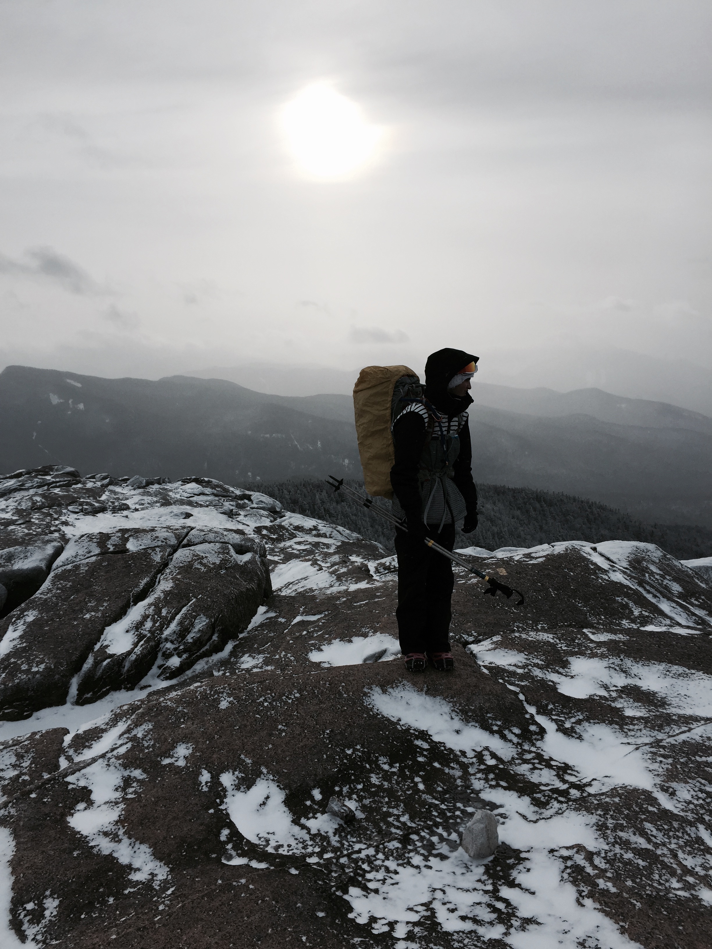
View from summit of Phelps
Park rangers stationed at the trailhead warned that the exposed summits were too dangerous to hike to. Shubert ignored them and parted with us to hike Algonquin anyway. The hike up Phelps was steep and icy. Trails in the Adirondacks differed from Pennsylvania trails because they did not switchback their way up the mountain, they went straight up the side. As we neared the top, the pitch became steeper and steeper until we reached a pygmy forest on the flat table lands. The cold wind whipped over the mountain and sapped heat from my body. We crouched to stay out of the wind. We made the summit, a single exposed boulder above pygmy trees, took some photos and went for cover. With wind chill, the temp was -35°F we ate our lunch in a snow cave underneath the pine trees. Our water bottles froze almost instantly after we removed them from their insulated sleeves. I scarfed down two frozen turkey sandwiches, some frozen cookies, and some frozen trail mix. I tried to eat my clementine but it was as hard as a baseball. Both of us were losing feeling in our hands and feet so we scrambled back to the base. We thought there was no way that Shubert had made the summit of Algonquin in this weather and we joked that he was dead, fully aware that it was a real possibility. When we returned to the parking lot a few hours later he was there, inexplicably. We practically hugged him when we had found he had made his journey safely.
The Adirondack Mountains are a very humbling place in the winter. They are beautiful, but deadly.