


Tornadoes, thunderstorms, flash flooding, droughts, heat–the state of Oklahoma experiences a variety of severe weather phenomena. Although extreme temperatures tend to not impact people’s lives as much as severe storms, it is fascinating to witness or learn about record-breaking temperatures. In the last several weeks in Pennsylvania, you might have noticed the large temperature swings from near freezing point one morning to the low 80s only a few days later. It may seem like nature cannot make up its mind as cold and warm air masses are constantly on the move. Coming from the Pacific Northwest, I have found these temperature swings to be quite unusual since I’ve been accustomed to a consistently mild, maritime climate. While a 50 degree or so temperature fluctuation over several days is noteworthy, how about a 110 degree temperature change within a week?
On February 10, 2011, the town of Nowata, OK dipped down to -31 degrees, the lowest temperature every recorded in Oklahoma! Just seven days later, on February 17, a record daily high temperature of 79 degrees was observed! Considering that the average high and low temperatures in Nowata, OK for February are 53 degrees and 29 degrees respectively, the incredible temperature swing was certainly a rare occurrence. Although the warming of the course of the week was actually quite gradual, the temperature change, nonetheless, is numerically impressive.
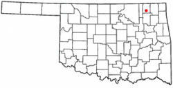
Prior to the record low temperature, all of Oklahoma experienced severe winter weather, including a snowstorm from January 31-February 1 that brought high winds and 30-48 cm (12-19 inches) of snow accumulation. In a 24-hour period on February 8-9, a state record snowfall of 68.6 cm (27 inches) was recorded. On the day of the cold record in Nowata, 38 cm (15 inches) of snow on the ground was measured.
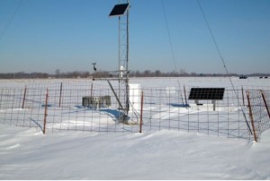
Calm winds, strong surface pressure (1,032 mb), leading to clear skies, and deep fresh snow led to the rapid loss of heat during the night before February 11. The snow depth significantly influenced the surface air temperature; nonetheless, members of the State Climate Extremes Committee (SCEC) unanimously approved the -31 degree reading. As the unusually dense and cold air mass moved out of the region, temperatures increased; however, there were still mounds of snow on the ground even when it was sunny and near 80 degrees. In fact, it became so unseasonably warm and dry that meteorologists even threatened a wildfire risk!
If one only looked at the average temperature of 34 degrees Celsius for February 2011 at Nowata, he or she would expect mostly chilly days. However, this large temperature swing goes to show that the weather can change drastically and quickly, more so in areas well inland. Thus, it is important to check the weather regularly because the climatic averages of a region are not always a reliable forecasting tool!