Tag Archives: Tourism

The luster pearl–Ivory Coast

Ivory Coast, as its name suggested, is located in the west coast of Africa. Ivory Coast used to be the most prosperous country in the Africa during the Cold War. People saw Ivory Coast as a luster pearl in West Africa in the past time. Although today’s Ivory Coast is no longer the most prosperous country in the whole Africa, Ivory Coast is still a good place to visit for the old cities, historical buildings and incredible natural beauty.

   There are two major cities in Ivory Coast: Abidjan and Yamoussoukro. Abidjan was the capital city in the past and Yamoussoukro is the capital city right now. However, Abidjan is actually the center of economics and culture till now. The whole city Abidjan was built on several small islands and peninsulas near the Ebrie lake. Those islands are connected by bridges, which make Abidjan a beautiful coast city.  Since Ivory Coast was one of the colony countries of France and Abidjan was the main city in the past, Abidjan has a French style. The beautiful streets, fantastic parks and historical universities made Abidjan the “little Paris” in the West Africa. Besides, Abidjan is located on the west coast of African continent, where near the Atlantic Ocean. As a result, the beaches in Abidjan is absolutely fantastic. One of the most famous beach in Abidjan is Assinie Beach. There are clear sky, cool sea water and soft white sands. It’s a perfect place for vacation. It’s not as crowded as Miami Beach and it’s not as expensive as Cancun. Besides beach, the location of Abidjan brings prosperous port economy. Abidjan Port was the biggest port in West Africa and the second biggest port in the whole Africa. If you walk along the port, you can not only enjoy the warm breeze, but also see how prosperous the economy of Ivory Coast was and how they created the “20-year miracle” during the Cold War.

     Another wonderful city in Ivory Coast is the capital city Yamoussoukro. The government of Ivory Coast changed the capital city into Yamoussoukro in 1983. Yamoussoukro started to become famous and dynamic since 1983. One of the most important crop in Yamoussoukro is cacao. There was a famous saying that one half of the cacaos we used nowadays is from Ivory Coast. The plantation of cacao is the core of Ivory Coast economy. Besides the development of economy, the culture and public infrastructure developed a lot since 80s. One of the most famous building in Yamoussoukro is Basilique de Notre Dame de la Paix de Yamoussoukro–the peace Notre Dame church of Yamoussoukro. This church is largest Catholic church all over the world. It was built during 1985 and 1989. It cost the government of Ivory Coast 3 billion dollars to build this church. After 1989, the church became the most famous and hottest attraction in Yamoussoukro. 

    The climate of Ivory Coast is tropical rainy climate, so there monsoon in Ivory Coast. In order to have a wonderful vacation in Ivory Coast, the best time to visit Ivory Coast is late spring. You can have the best travel experience in Ivory Coast if you visit in April or May.

To draw a brief conclusion, Ivory Coast is definitely a fantastic place for travel. Welcome to Ivory Coast.

1111


Welcome to Djibouti

Welcome to Djibouti

The Republic of Djibouti, geographically located at coordinates 11 30 N, 43 00 E, is perched on the northeast coast of the Horn of Africa. It is strategically located at the crossroads of the Gulf of Aden and the Red Sea. Border-wise, she has Eritrea to her north for 68mi, Ethiopia stretches from the west to the southwest with a shared border line of 217mi, and to her south lies Somalia for another 36mi. Djibouti’s land area is 8958mi². Total water area is 7.7220mi². Djibouti has a total coastline of 195mi. The capital, Djibouti, which is also the largest city in the country is located on the southern coast of the Gulf of Tadjoura A 2007 estimate put the country’s population around 773,000. French and Arabic are the official language, although Somali and Afar are widely spoken. Djibouti is dominated by Moslems who account for about 93% of the population and Christians are about 7%. 0.23mi of her coastline forms the narrow Gulf of Tadjoura. The northern coast near the Eritrean border faces the Strait of Bab al Mandab on the southwestern tip of Yemen.
This country is formed of a triangular depression. This is as a result of the collision of the general tectonic trends of the Great Rift Valleys of Eastern Africa. These run North-South and NorthWest-SouthEast and have generated a complex fragmented relief of high blocks and subsidence zones. Formed by the Ethiopian Highland in the west, The Somali Plateau in the south and the Danakil Horst in the east, Cenozoic sedimentary and volcanic rocks make up most of the country.
Her climate can best be described as that of a desert, having attributes of being mostly torrid and dry.Djibouti has about 163.5 mm (6.4 in) of rainfall per year. The driest month is June, averaging about 0.1mm of rain as compared to April which has about 28.9mm of rain, making it the wettest month in the region.
There are 5 lakes in Djibouti. Lake Abbe is the ultimate destination of the waters of the Awash River. It lies at the Afar Triple Junction, the central meeting place for the three pieces of the Earth’s crust, a defining feature of the Afar Depression. Here three pieces of Earth’s crust are each pulling away from that central point, though not all at the same speed. Lake Afambo is one of a chain of lakes into which the Awash river empties its waters. It is located at the eastern end of the Afar region of EthiopiaThe lake lies on a roughly north-south axis, 13 kilometers long by two wide, having 1760 hectares of open water.[1]Afambo receives its inflow from Lake Gummare from a channel at its northern point, and has its outflow in the swamps on its southwest shores where it empties into Lake Bario. Lake Assal is a crater lake in central-western Djibouti. It is located at the western end of Gulf of Tadjoura in the Tadjoura Region, touching Dikhil Region, at the top of the Great Rift Valley, some 120 km (75 mi) west of Djibouti city. Lake Assal is a saline lake which lies 155 m (509 ft) below sea level in the Afar Triangle, making it the lowest point on land in Africa and the third-lowest land depression on Earth after the Dead Sea and Sea of Galilee. No outflow occurs from the lake, and due to high evaporation, the salinity level of its waters is 10 times that of the sea, making it the most saline in the world after Don Juan Pond.[1][2][3][4][5]. Lake Assal is the world’s largest salt reserve. Te other lakes are Lake Gummare and Lake Bario. Djibouti has no permanent rivers but instead has a number of permanently or intermittently dry riverbeds called Wadis.
Djibouti is an ideal vacation destination for the entire family. She has year round favorable weather for vacationing. Warm and sometimes humid, the average temperature is 29.9 degrees Celsius (85.8 degrees Fahrenheit). This makes outdoors activity fun. Djibouti has a full palette for all those who like to have fun, and have a feel of nature in the process. We have it all, from a cool day at the beach to hiking and climbing.
For those who like the water, Djibouti boasts of a variety of beaches with white sands, whist others have darker sands, and some also consist of volcanic rock features. You can just chill out at the beach during the day and enjoy a cool breeze while you soak in the beauty, and relax with the calm waters providing serene sounds. Alternatively, you can party in the evening with other tourists and locals when you attend one of her world famous beach partys, where you can listen or dance to, contemporary local music with a mix of arabian and western infused music while you enjoy cool drinks in a scenic atmosphere. One can also sample exotic cuisine and snacks from one of the numerous international class restaurants that line the beaches.
The Djibouti tourist board sets strict and well enforced safety and sanitation standards for hotels and restaurants that leave the customer with nothing less than a great variety of clean and world class hotels, resorts, restaurants, night clubs and discos. Your only worry when you patronize any of these services is your potential and tendency to overstay, which your are more than welcome to do. From prompt and courteous service, to well dressed and professional staff who aim to make your stay an enjoyable one. Our hotels and resorts boast of industry leading spas and recreational facilities that are well managed and maintained.
If you would rather tour the country, there are various breathtaking sites, historical places, lakes, rivers, mountains. The climate and weather supports such adventures giving you nothing but cool breezes all the way. There is the occasional rainfall that further cools the weather. Your only problem would be where to start and in which direction to head.

300px-DjiboutiLacAssal2 300px-DjiboutiLacAssal2 Djibouti-aerial-sea-web Djibouti-boat-web Djibouti Djibouti3_web DjiboutiPort EF-D4-47-9E-57-60-39-B2-36-B6-0D-AE-08-F9-D8-75-05-3A-7C-10 Facts1 Moucha-Island_interior_billboard bali_safari djibouti-beach djibouti survol_djibouti07-500x375 tumblr_m4wlx5Fapl1rx8i7eo1_500 1 2 3 4 5 6

Sources:

http://www.djibouti.climatemps.com/precipitation.php

http://en.wikipedia.org/wiki/Djibouti

http://en.wikipedia.org/wiki/Category:Lakes_of_Djibouti
1.Robert Mepham, R. H. Hughes, and J. S. Hughes, A directory of African wetlands, (Cambridge: IUCN, UNEP and WCMC, 1992), p. 166
Warren, John K. (23 February 2006).Evaporites: sediments, resources and hydrocarbons. Birkhäuser. p.280.ISBN 978-3-540-26011-0. Retrieved 27 May 2011.
1. “Lake Assal”. Encylopeadeia Brittanica. Retrieved 25 May 2011.
2. “Lake Assal – Djibouti”. British Broadcasting Corporation (BBC). Retrieved 25 May 2011.
3. “A life of constant thirst beside Djibouti’s Lake Assal”. =British Broadcasting Corporation (BBC). 4 December 2010. Retrieved 25 May 2011.
4. “Lake Salt Project, Djibouti:Environmental Impact Assessment”. Government of Djibouti:Salt Investment S.A.Z.F. November 2008. pp.1–xii, 29. Retrieved 25 May 2011.


Visit Eritrea!

You fly in to the beautiful, thriving capital Asmara, where the streets are lined with beautiful shops, café’s and restaurants. If you choose to travel west, you will encounter the hot, dry, majestic desert, which so conveniently backs up to the Red Sea, offering many sights to see. Eastward, it the cooler more temperate side of things, where the mountains and high lands are your playground, begging you to explore. The beautiful country of Eritrea is one of my most beautiful and relatively undiscovered countries around. A trip here would create memories and stories that would last a lifetime.

Eritrea is located in east Africa, south of Sudan and North of Ethiopia. Its different climates of desert, mountains, and highlands, offer a wide spectrum of climate preferences and geographically different areas. Eritrea borders the Red Sea to the west. Eritrea gets an average rainfall of 24 inches a year. In comparison, Eritrea is slightly larger than Pennsylvania.


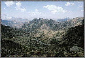
The mountainous regions are what truly define Eritrea. The highest point in Eritrea is the mountain Emba Soira, which is roughly 9,900 feet above sea level. To scale the mountain, one must drive from the city of Senafe on a dirt road. From there it is a multi-hour trek to the top, but just seeing the summit is worth it.

TheMountainsOfEritrea2L

Another big destination is Dahlak Marine National Park, which is located right off the coast of Eritrea. The island has flourishing wildlife for everyone to see. It has been abandoned ever since the Ethiopian-Eritrean war. Over 350 different species of fish reside there and people can also see the remains of a shipwreck. Scuba diving is also allowed there as well. Since it is now government regulated, it is completely safe and well kempt. It is a place that visitors in the country must go see.

50996245

Another hot destination spot is the costal city of Massawa. This original capital of Eritrea has tons of old architecture dating back to the ancient Egyptians. They also have buildings from the Ottoman Empire when they occupied the city in 1557. Massawa has beautiful beaches that sit right in the bay. There is also an Eritrean war memorial in the center of the city, commemorating their independence. Massawa is easily accessible from Asmara by train. There are also ferries that connect Massawa to Dahlak. This is one town that has beautiful sights and recreation spots.

Eritrean is a vast and majestic country. Its physical features can’t be overlooked. The country is basically split east and west by the East African Rift. The east is the hot and dry desert and the west is the temperate and fertile highlands. However the country is split into three sections including the 2 previously mentioned and costal plains, which lie through the southeastern part of the country. One important body of water is the Bab-el-Mandeb strait. The strait connects the coasts of Eritrea and Yemen.

Eritea is a thriving country with many magnificent places to see. It should be a hot destination and your next vacation.


South Sudan Tourism!!!

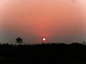
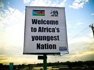
The youngest nation in the world! And the most beautiful sunset in the earth!

Do you want to enjoy the heaven on the earth? Then, welcome to Eastern Africa, South Sudan!

sunset

The sudd – a huge grassland seasonally flooded by the Nile River, is the largest wetland in the world. The sudd provides food and water to large populations of migrating birds, with more than 400 species of birds. The swamp is a haven for migrating animals, especially antelopes such as the endangered Nile lechwe, Tiang, Reedbuck, and the world’s largest population of white -eared kob, estimated at around 1.2 million. 80 percent of the land is arable and 75 percent of Sudan’s oil reserves are in South Sudan.

south_sudan_flag

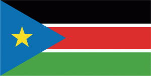
South Sudan has a total land area of approximately 620,000 sq. km. population 9 million (UN estimate, but the South Sudan government estimates population at 11 million – 13 million). 51 percent of the population is under 18. More than 200 ethnic groups are included; one of the most linguistically diverse areas in the world. South Sudan becomes the 56th country in Africa, 193rd member of the UN and 196th country in the world and potentially, the 6th member of the EAC.

South Sudan’s protected area of Bandingilo National Park hosts the second-largest wildlife migration in the world. Habitats in the country include grasslands, high-altitude plateaus and escarpments, wooded and grassy savannas, floodplains, and wetlands. Associated wildlife species include the endemic white-eared kob and Nile Lechwe, as well as elephants, giraffes, common eland, giant eland, oryx, lions, African wild dogs, Cape buffalo, and topi (locally called tiang). Little is known about the white-eared kob and tiang, both types of antelope, whose magnificent migrations were legendary before the civil war. The Boma-Jonglei Landscape region encompasses Boma National Park, broad pasturelands and floodplains, Bandingilo National Park, and the Sudd, a vast area of swamp and seasonally-flooded grasslands that includes the Zeraf Wildlife Reserve.

Now, welcome to Juba, the capital and largest city of South Sudan. The City is situated on the White Nile and functions as the seat and Metropolis of Juba country. Juba has a tropical wet and dry climate, and, as it lies near the equator, temperatures are hot. However, little rain falls from November to March, which is also the time of the year with the hottest temperatures, reaching 38o in February. Arabic seems to be the Language of business. One of the fastest growing cities in the world, Juba Sudan is developing at a quick pace with boundless opportunities. Not only does Juba have a profusion of natural resources, Juba also contains luscious jungles as well. Not to mention, South Sudan features the second largest wildlife migration in the world. While the tourist attractions are limited, there are plenty of entertaining hotspots and nightlife in Juba. With the country claiming independence on July 9th, 2011, there is no better time to visit and celebrate the latest Nation in the world.

The City is situated on the White Nile and functions as the seat and Metropolis of Juba country. Juba has a tropical wet and dry climate, and, as it lies near the equator, temperatures are hot. However, little rain falls from November to March, which is also the time of the year with the hottest temperatures, reaching 38o in February. Arabic seems to be the Language of business.

youngest nation

Now, are you ready to pack up for South Sudan tourism!?embassy of the republic of south sudan

The Beauty of Somaliland

Somalia is a country located at the Horn of Africa. It is bordered by Djibouti to the northwest, Ethiopia to the west, and Kenya to the southwest. To its’ eastern and southern shores it is covered by the Golf of Aden and the Indian Ocean. Somalia’s terrains primarily consist of plateaus, plains, and highlands. The country is also one of the thirteen countries located on the Equator keeping the country’s climate warm all year round.

Somaliland is a part of Somalia that separated and formed an independent country. So far, their economy has been growing and waiting for further recognition from the rest of the world as a independent country. Somaliland remains rich in art and culture, with their own type of cultural and religious festivals. The country is primarily Sunni Muslim, which makes up the countries national identity.

Somaliland has great hotels like the Ambassadors Hotel, Safari Hotel, and Rays Hotel Borama located right on the oceanfront with great access to the beach and at extraordinary cheap rates. Each hotel has its own restaurants, and is fairly inexpensive dependent on the place you go. From one review from the Ambassadors Hotel a individual stated, “All meals start with a free bowl of vegetable soup and bread. Good soup, and I don’t even like soup. The menu is huge and everything is available. I tried lasagna, kebabs and steak. All were delicious. Salads are fantastic and fresh. I really enjoyed the Russian Salad. All non-alcoholic drinks are available including milkshakes. You can’t go wrong with whatever you order.”

During your daytime adventures Somaliland offers multiple places to exploring. From Laas Gaal Caves or Dhagax Kure rock paintings, where you can see cave paintings that are thousands of years old that are in extraordinary condition. Also, you have the Golis Escarpment, which is a road that climbs 700 meters and over 10km through the mountains and Berbera, an old harbor town. Berbera is a harbor that’s been around since ancient times because it is between the Indian Ocean and Red Sea making it maritime trading Centre. Now while on the shores of Somaliland if you go to the town of Zeila it is known for its offshore islands, coral reef, and mangroves. The coastal city of Berbera is known for its’ beautiful beaches that offer amazing snorkeling and scuba diving.

In conclusion, Somaliland is a beautiful country that has the ability for continuous growth and prosperity. This country has fought its’ way through a civil war, and now is fighting its’ way for recognition from the rest of the world. Its reputation has so far been tainted by its counterpart below it. However, the people remained strong, and continue to look towards the future. It is my belief that if this part of the world gets the recognition it truly deserves it will become an even more amazing place to visit. We, as people, can help with this by becoming understanding, and by spreading the word about how they decided to fight the odds and won.

images