Latitude: 41.7568N
Longitude: 76.3265W
Click here for Google map
Elevation: 341 m ASL
Installation Date: 5 May 2015
Decommissioning Date: 28 Feb 2017
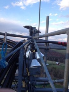
Sampling Height: 59 m AGL
In-situ CH4 Instrument: FCDS2047
(July 2016 – 20 Dec 2016: CFADS2401 installed as temporary instrument.)
| Reference Tank | CH4 (ppb) x2004a | 12CH4 (ppb) | 13CH4 (ppb) | δ (per mil) | CO2 (ppm) | Pressure (psi)/ Date |
| CB10734 (NOAA/INSTAAR) | 1878.53 | 1859.3 | 19.2 | -47.254 | 397.09 | 2050 May 2015; 1910 Jan 2016; 1850 Dec 2016 |
| CA06438 (Scott-Marrin/PSU) | 2064.6 | 2042.3 | 22.3 | -23.8 | 398.25* | 1930 Jan 2016; 1550 Dec 2016 |
| CA05419 (Scott-Marrin/PSU) | 10534 | 10422 | 112.0 | -38.48 | 400.14* | 1950 Jan 2016; 1650 Dec 2016 |
*Field calibrated using round robin tanks.

