As part of a pilot study, two towers were instrumented, one in rural New York as a background site and the other in the midst of natural gas extraction in northeastern Pennsylvania. Cavity ring down spectrometer measurements of H2O, CH4, and CO2 mole fractions are collected at these tower sites.
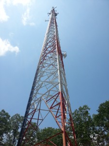
- Tower at NY Site on 6/21/13

Surface weather stations will be used for weather monitoring. The weather and mole fraction data will provide the basis for our analyses of methane emissions. We will compare the “background” conditions to mole fractions downwind or within the fracking region, and segregate these data according to wind direction and atmospheric stability conditions. In addition, we will compare our results with mobile measurements collected around the PA fracking sites with vehicles equipped with methane monitoring systems. The mobile measurements will show how strongly our tower measurements might be influenced by a few nearby sources vs. a larger number of more distant sources of methane. We will construct a simple boundary layer budget to infer emissions from the differences in methane mole fractions observed with the two towers.

Locations of wells in reference to the PSU Marcellus Pilot Project Sites. Red dots represent legally permitted wells as of January 2013.

- Equipment enclosure at NY Site


- Equipment setup at NY Site

This is a sample of the data we have collected.
